

Price: upon inquiry
Destinations Visited: Ganzi (3 nights), Derge(2 nights), Chola (3 night),
Departure: Private Tour / Flexible Date
As over-tourism has taken over more and more places in China. Less and less unexplored places are available. Sichuan Travel Guide keeps its traditions of exploring and offering new and interesting treks and hiking tours in remote and wild places in Sichuan. This 9-day Derge and Ganzi hiking tour goes to the unexplored valleys, high mountain ridges, beautiful lakes and hidden monasteries and nunneries of Kham, providing you unique experience. This trip is outside of the normal travel destinations that you will be the only hikers/humans in the mountains we go to.
Book NowPlease be noted this tour starts by Ganzi Airport. You will need to book your own flight to Ganzi Gesar Airport from TFU (note the flight is usually in early morning, you are recommended to stay 1 night by the airport hotel and catch the early flight to Ganzi), please send us your requires if you want us to book the flight for you. Be well-prepared for the high altitude when you land by Ganzi Airport to have your warm clothes handy due to changing weather and do not stress yourself too much due to less oxygen. The airport is at the altitude of 4000m. Note to keep your rain-proof, warm clothing and drinking water handy all the time.
Arrive by flight by around usually 10am in the morning and you will be greeted by your guide at the airport and then drive for around 2h along good road with excellent mountain views all the way to Ganzi Town where you will have lunch. You will be briefed by your guide on the trip plan, safety issues, packing ideas, general culture information and etiquette and answer your questions. This part of Tibet is located within Kham and food and hotel have improved a lot than 10 years ago but are still very limited. If you have higher standards requires on diet and hotels then they are not available, so please be aware of this before signing up this trip.
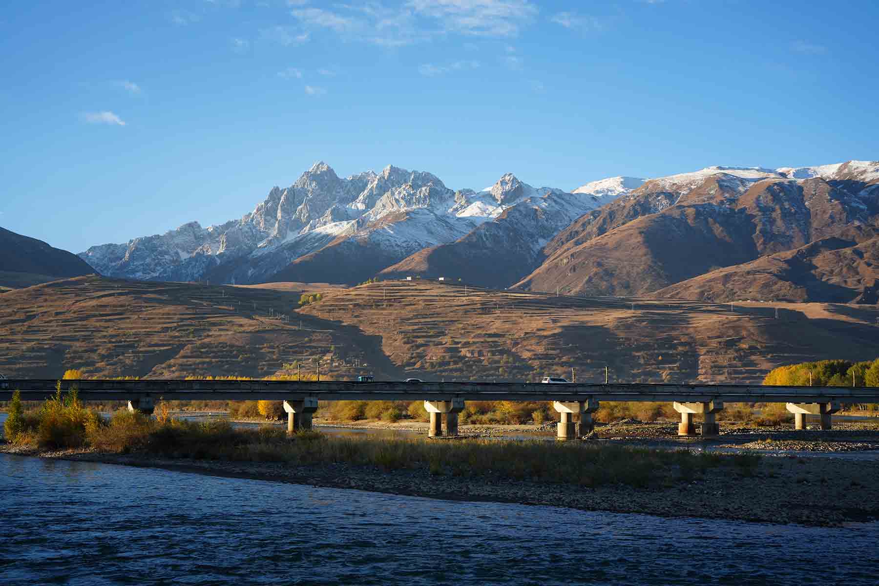
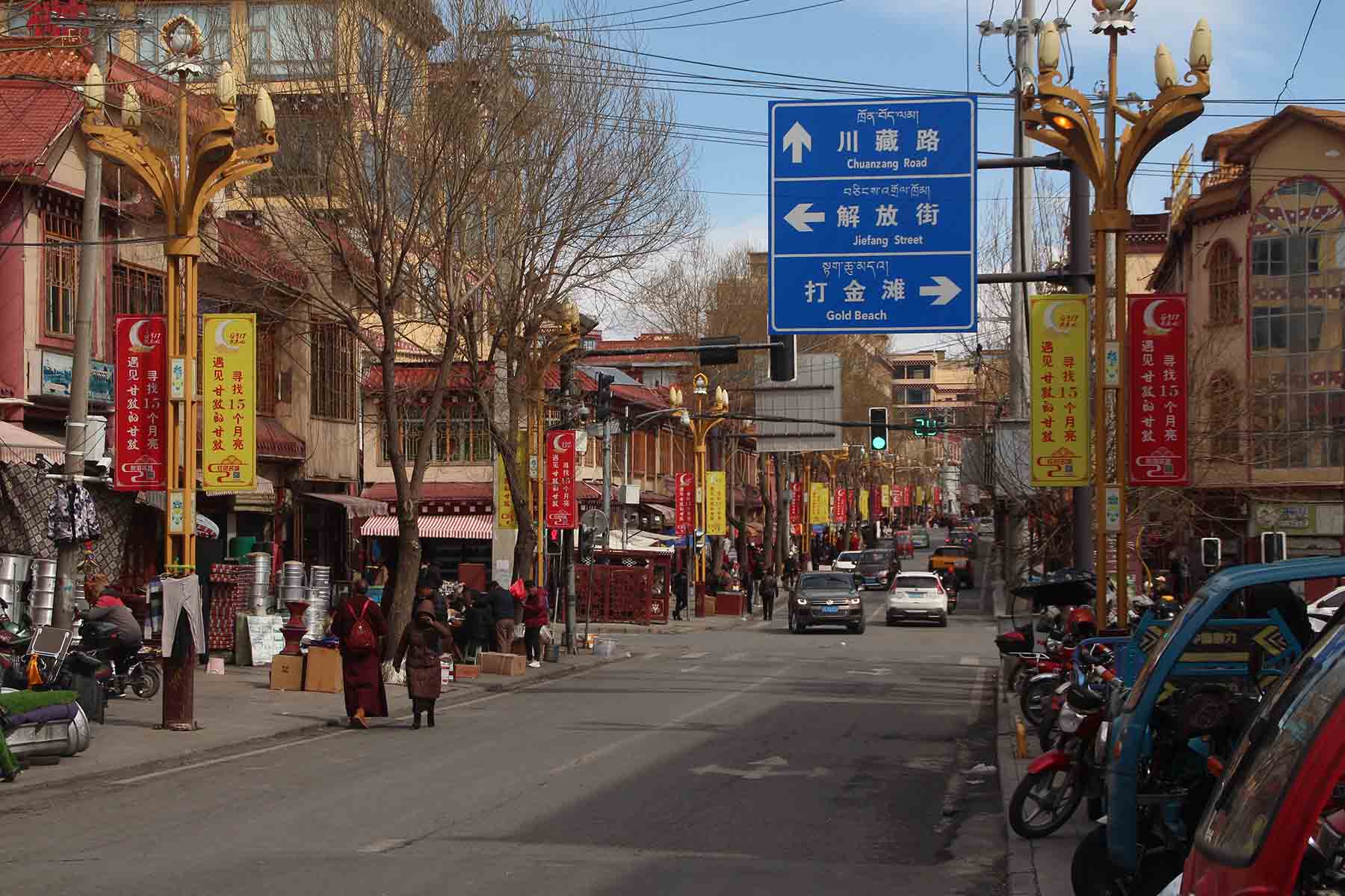
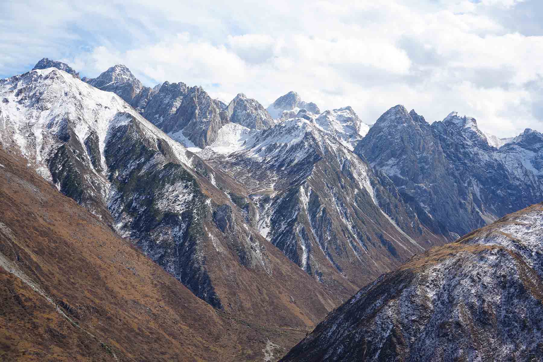
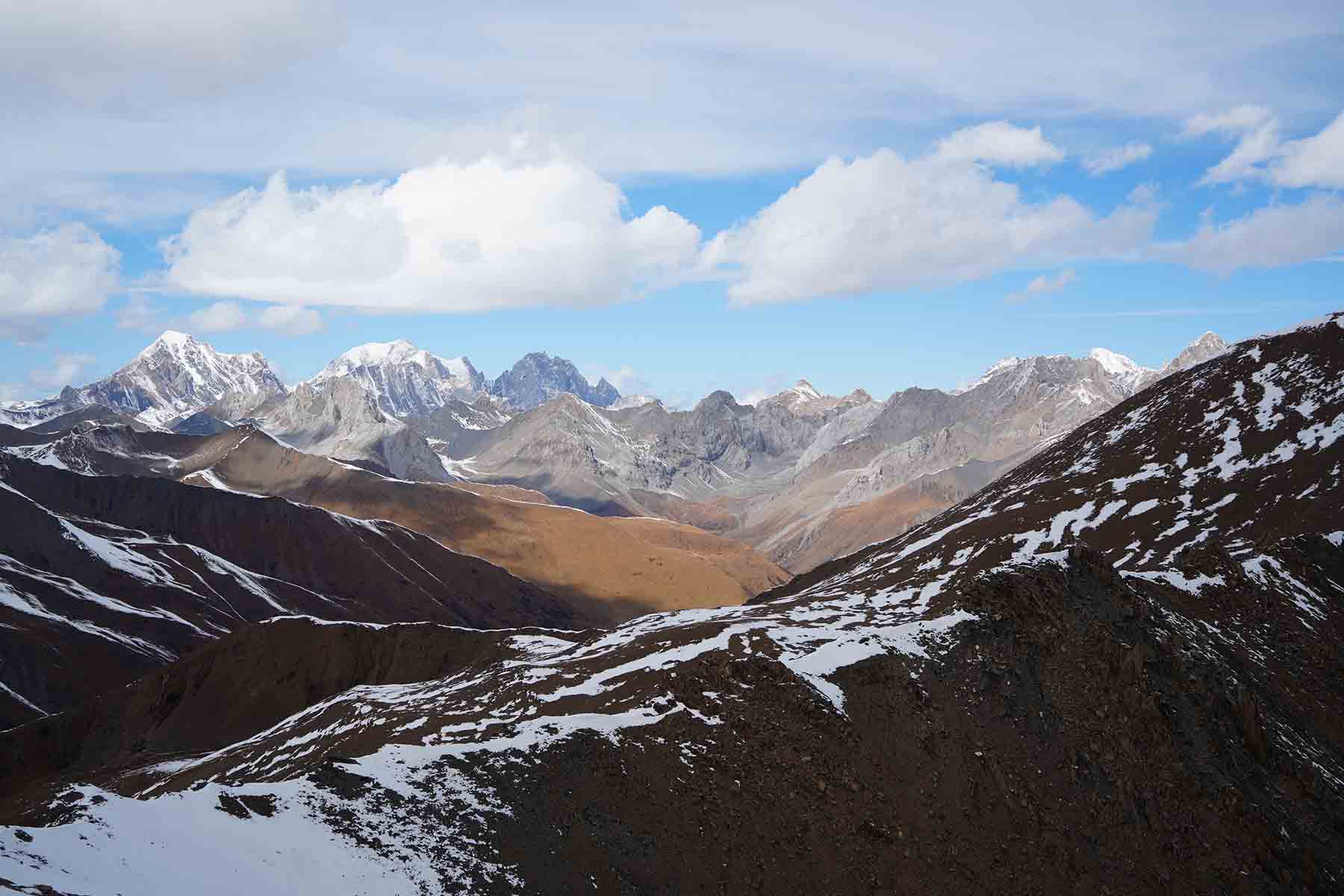
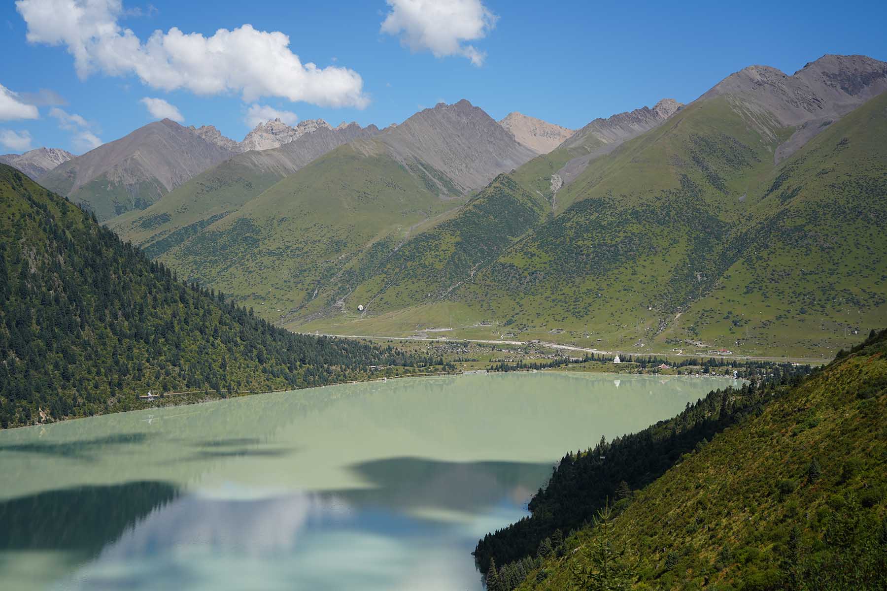
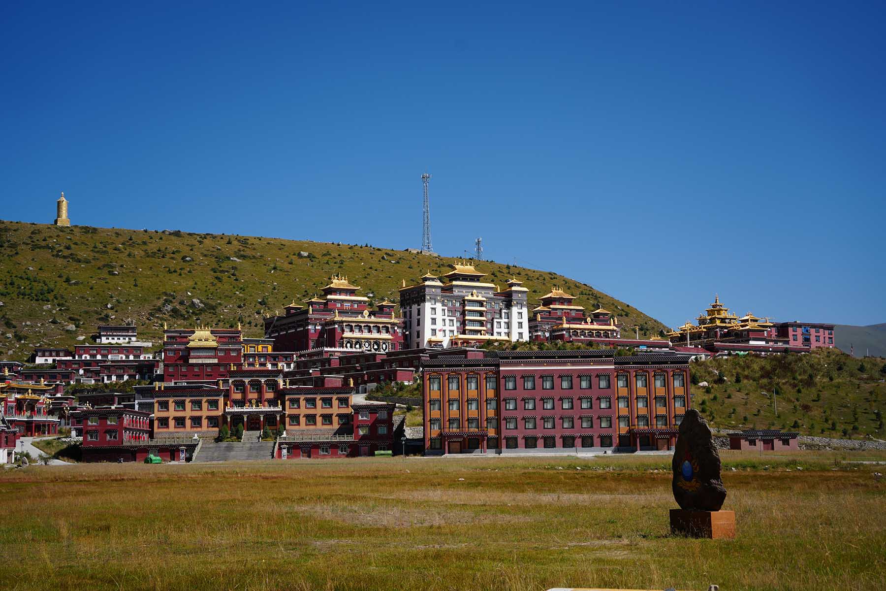
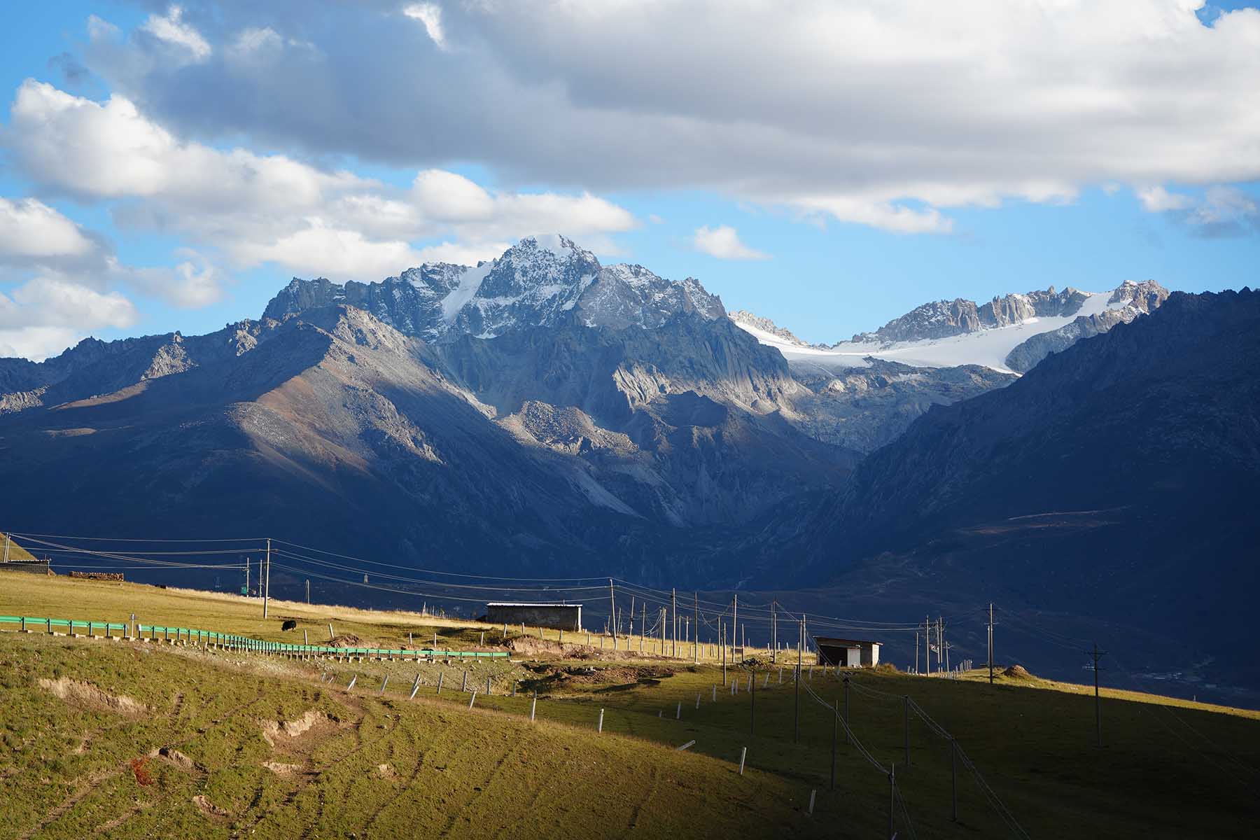
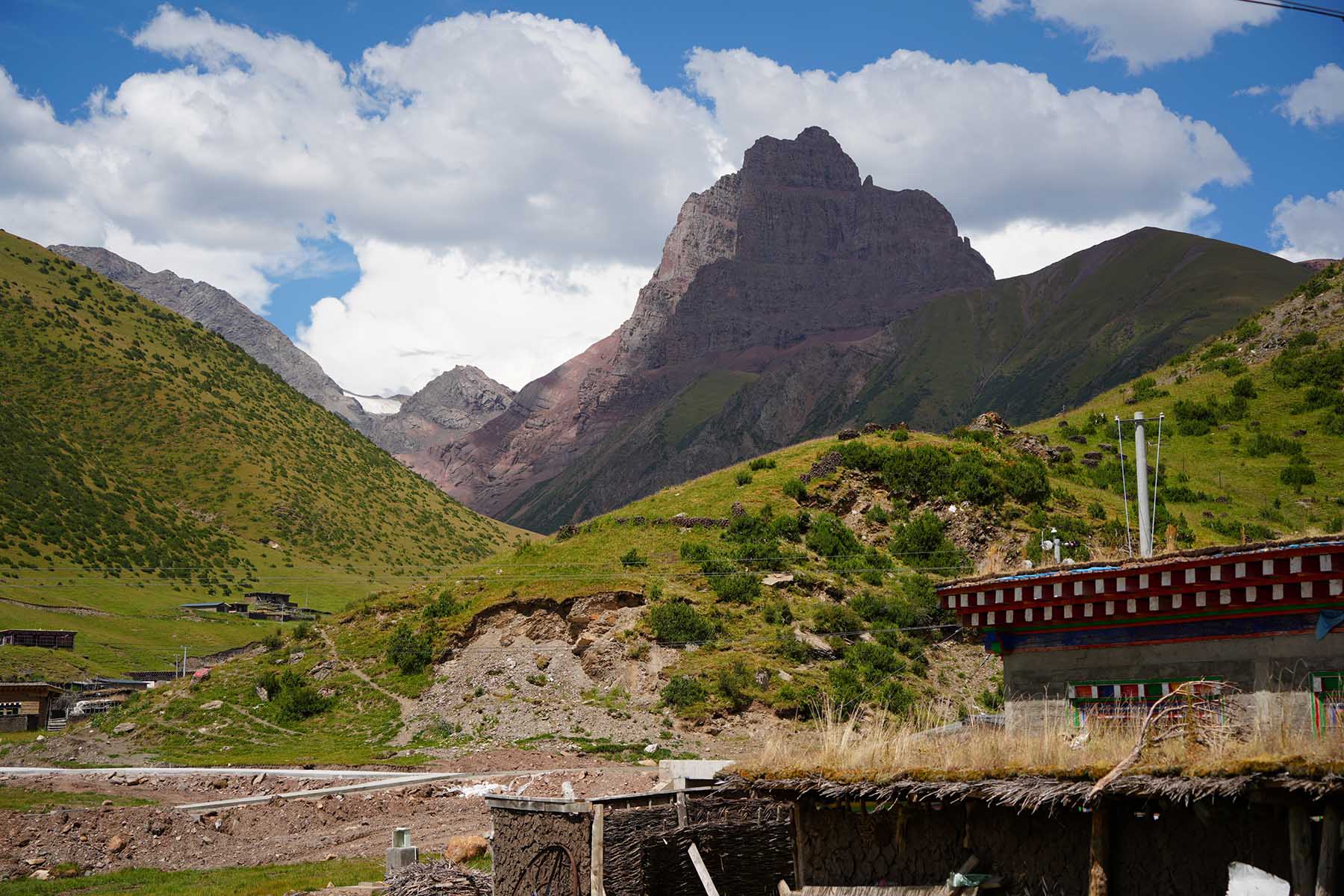
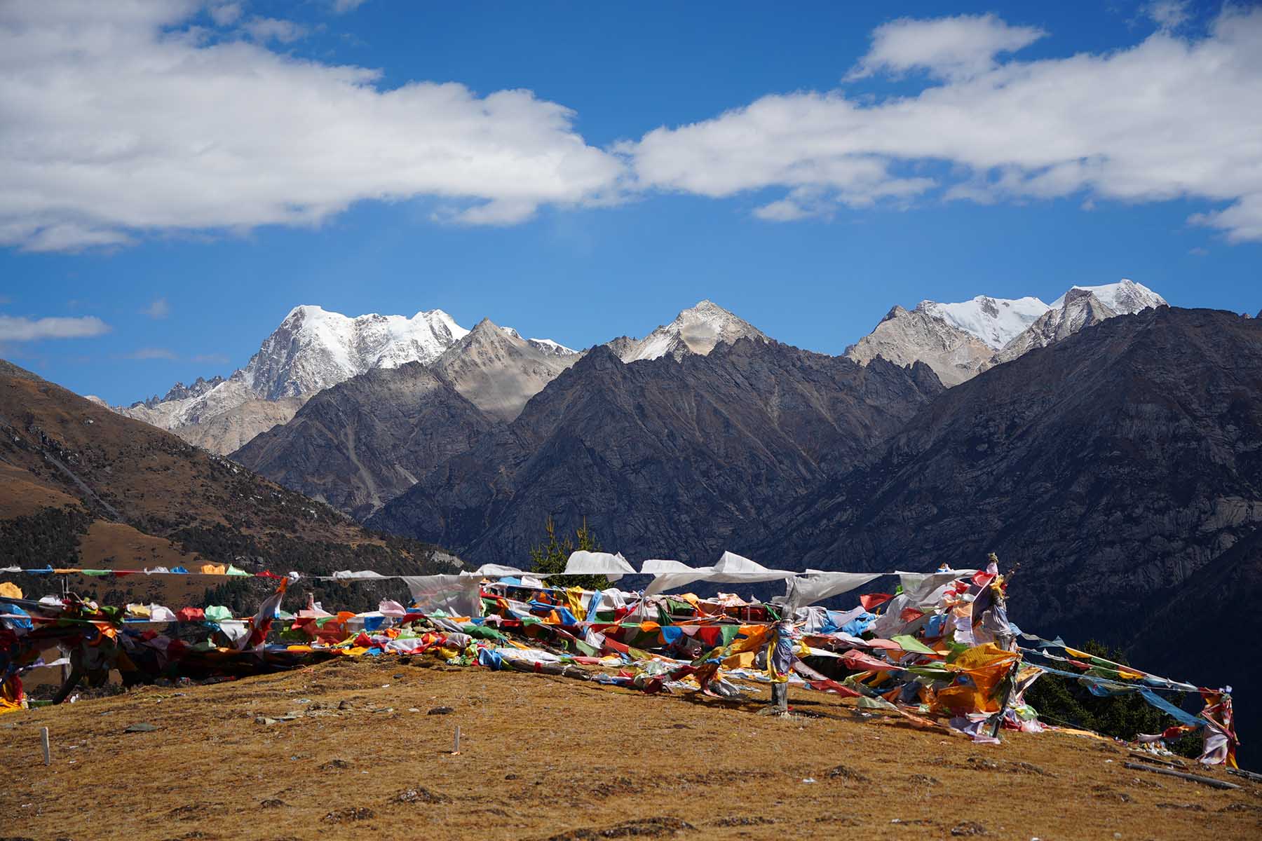
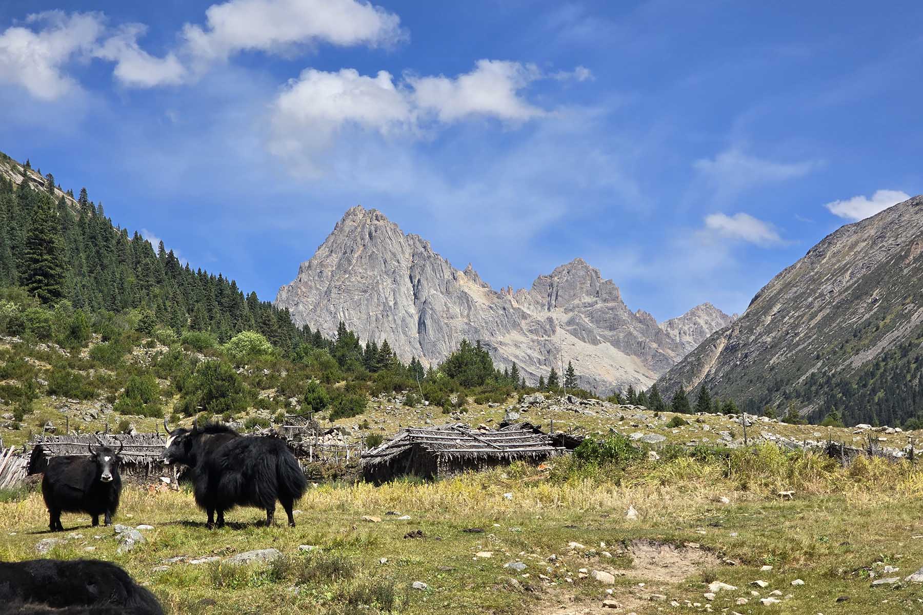
In the afternoon we will drive high to Luogo Pass and do acclimating walk by the ridge at around 4000m to 4400m for the rest of the day. During the walking we will have excellent views of the mountains of Kawalori, a series of near 6000m mountains located by the east of Yalong River, the biggest tributary river of Yangtze. Kawalori mountains are not famous and is an isolated massif with 4 peaks/summits at around 5900m+, with a big drop of around 2800m by its south and west river valley from the top of the mountains. From where we walk will see its north steep walls. Depending on the weather we will spend 2-4 hours here by the high pass before we start to drive back to hotel in Ganzi. Feel free to walk and explore the Kham Tibetan town on the traditional Sichuan-Tibet highway and now a less-favored travel route of G317 town.
Driving 3h, Total walking 6-10km, easy pace;
Overnight hotel by 3300m
Ganzi Landscape
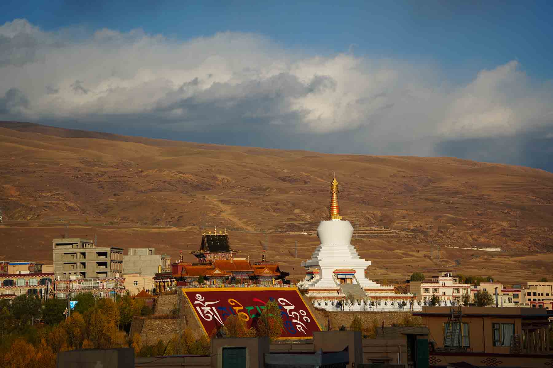
Ganzi Town
Mt. Kawalori from Ganzi
Tibetan Kham of Ganzi
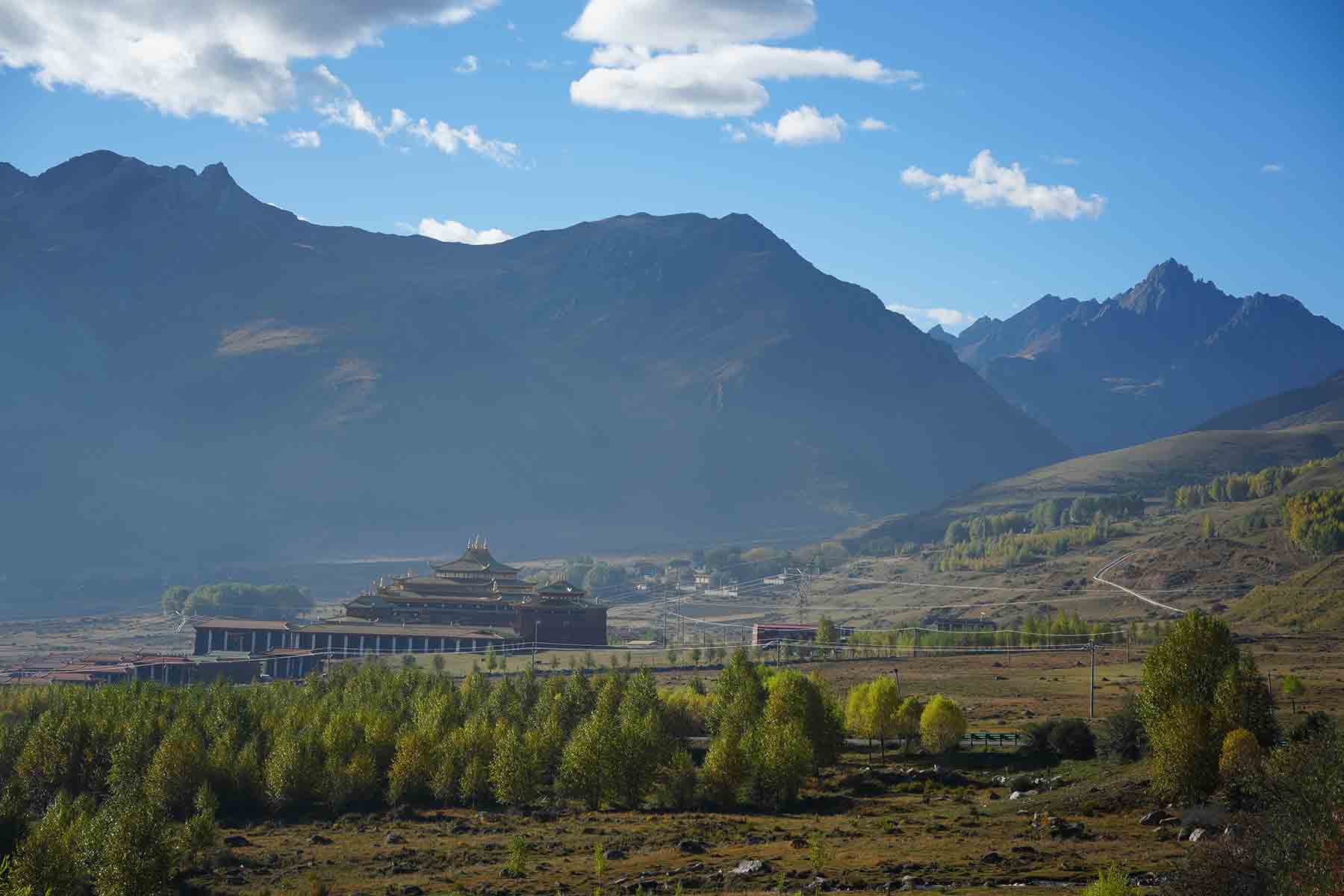
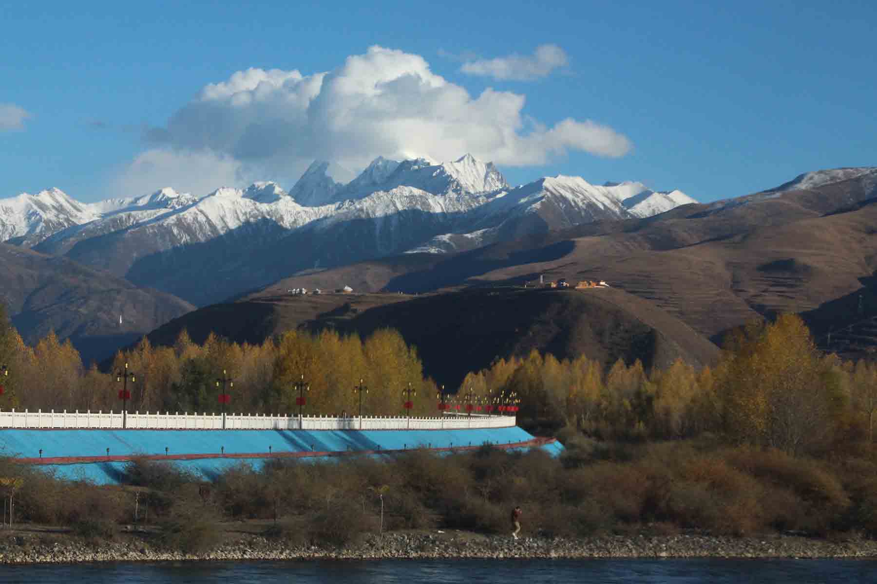
Garze along Yalong River
Mt. Kawalori
We will have a vehicle with us all the way of the trip. Some days we change hotels some days we don’t change hotels but everyday we will have some driving need to do in order to get to places where the good and beautiful hikings are. You are expected to have day pack with you with stuff you’ll need for each day’s hiking including your snack lunch, drinking water, warm clothing, gloves, hat, sunglasses, sun cream, lip oil, rainproof, jackets, important possessions such as cash and passport, etc.
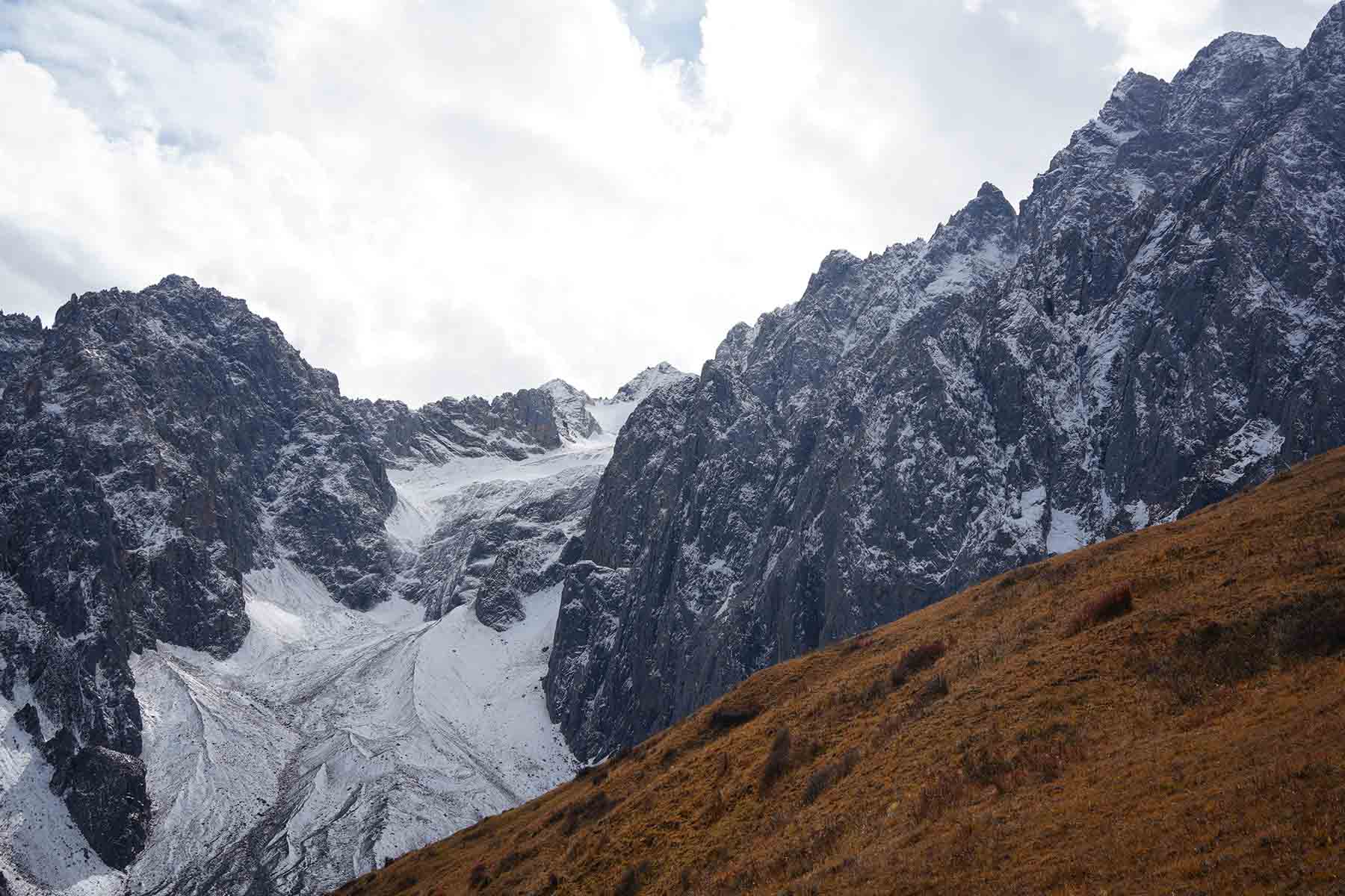
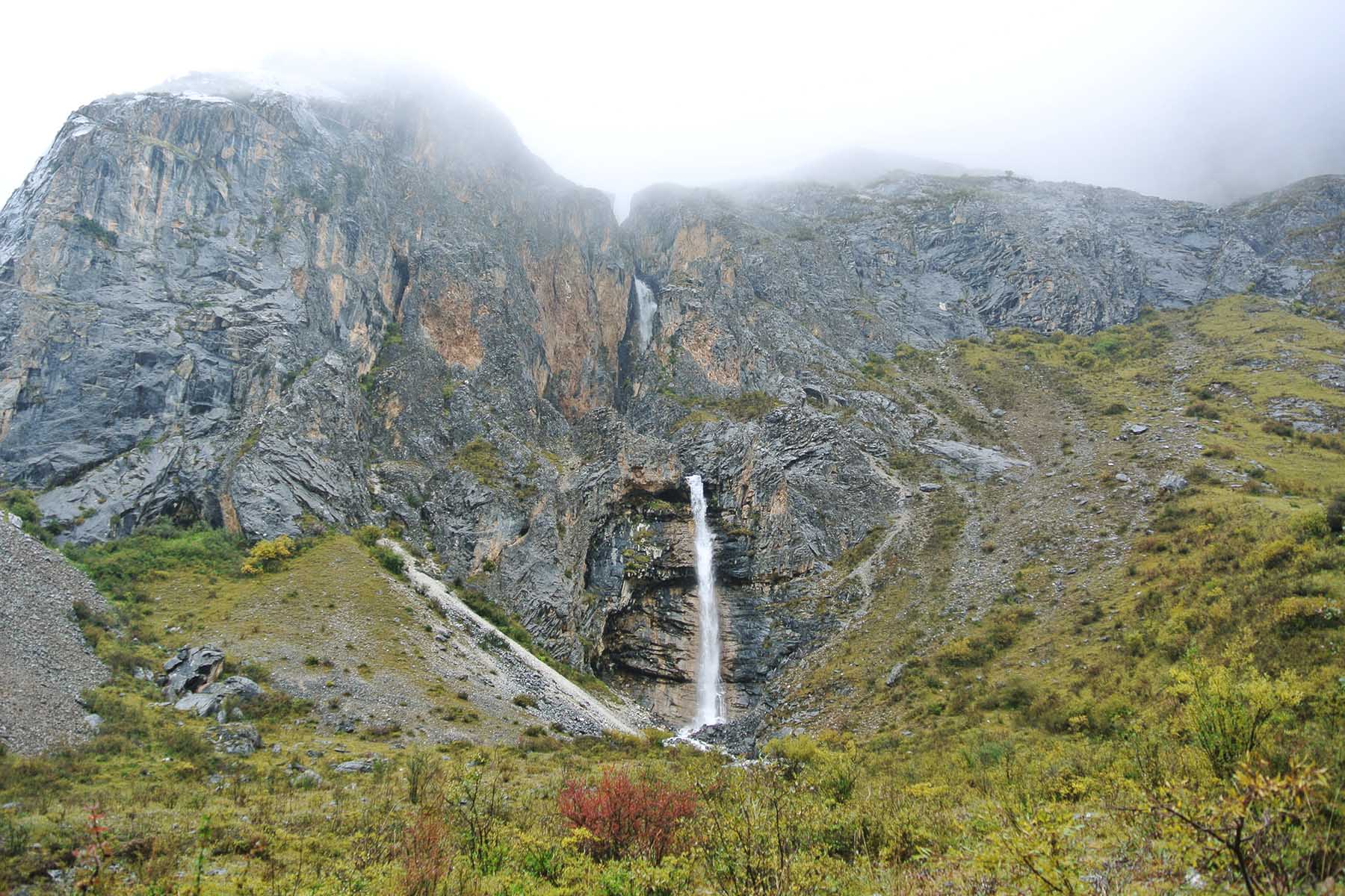
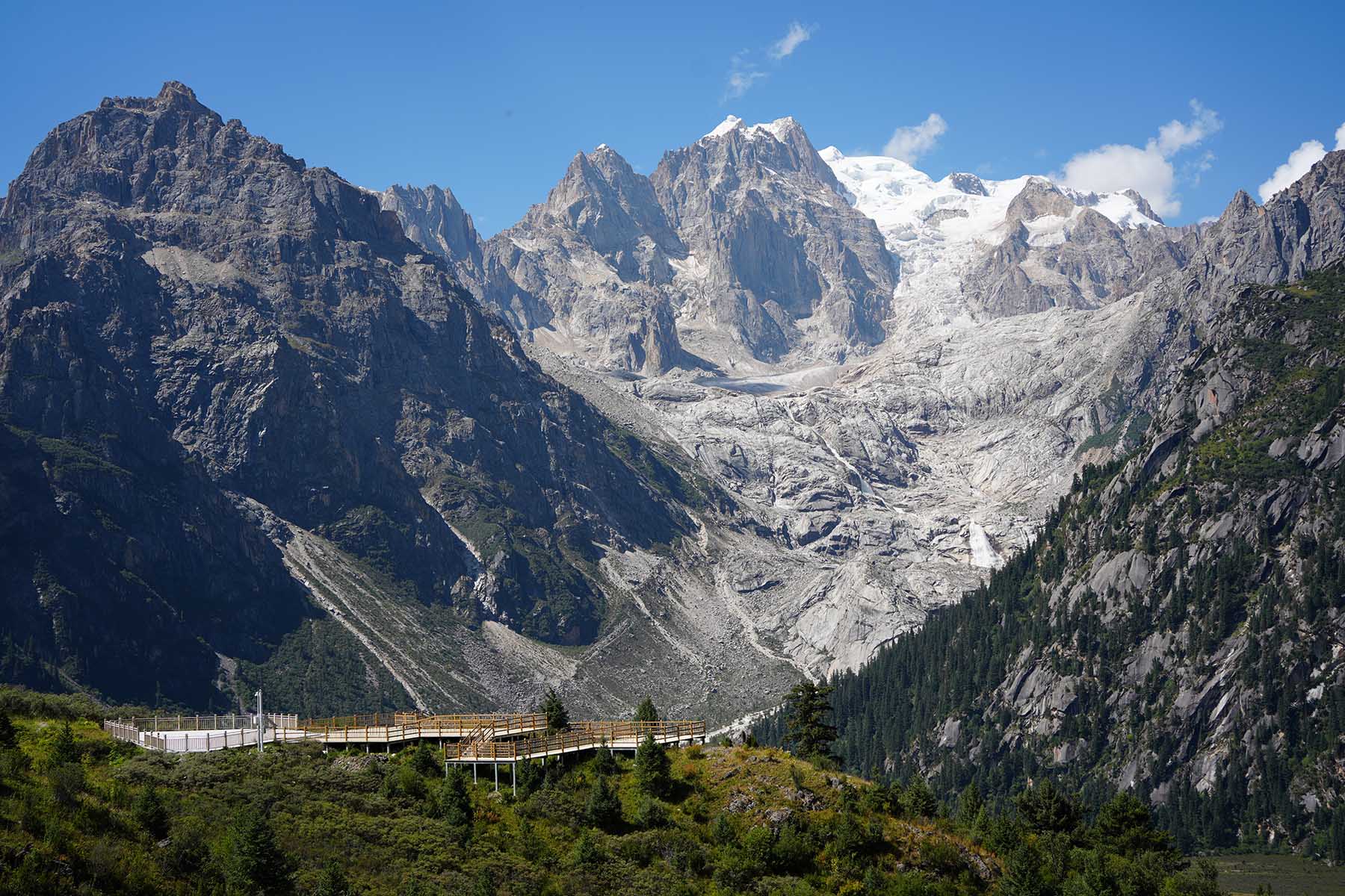
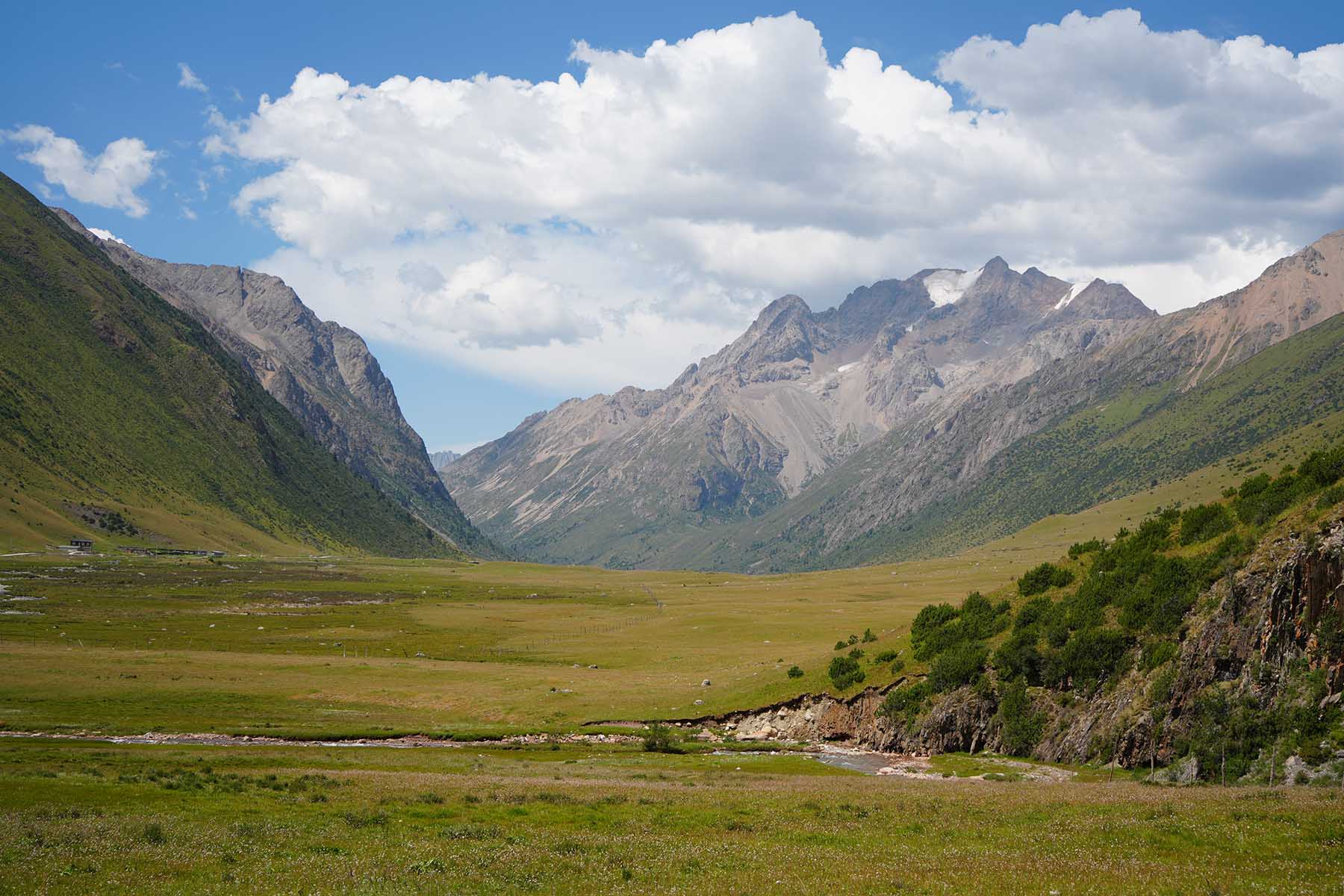
Today we will drive out from hotel for around 20min, and do hard walk by the north of Gangga Mountains. It is a long, no-road access valley with great views of mountains and river. We have 2 hiking plans for today for different seasons and the choice will depend on trail and weather conditions in the season.
Winter Plan: 10km between 3700m and 4300m
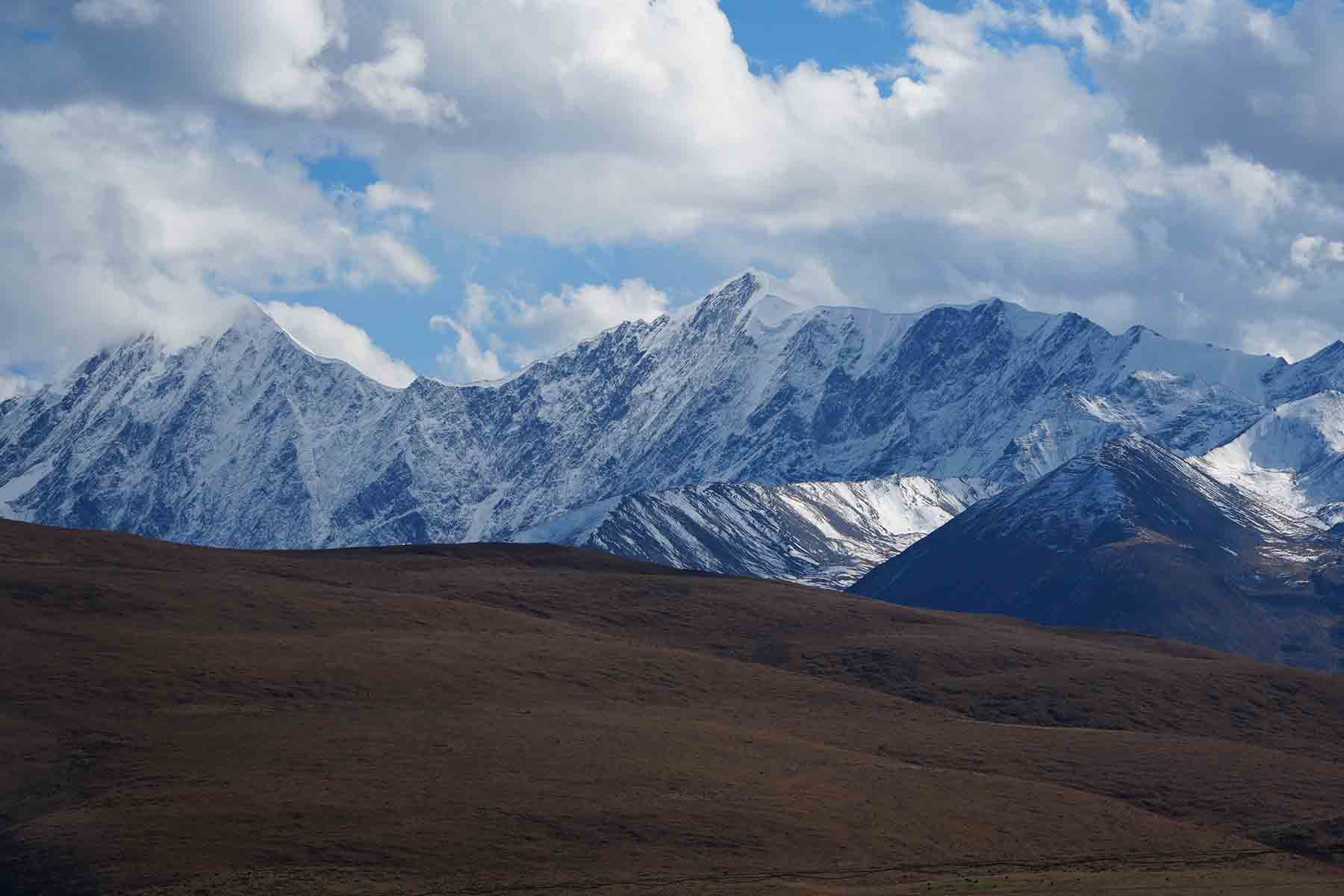
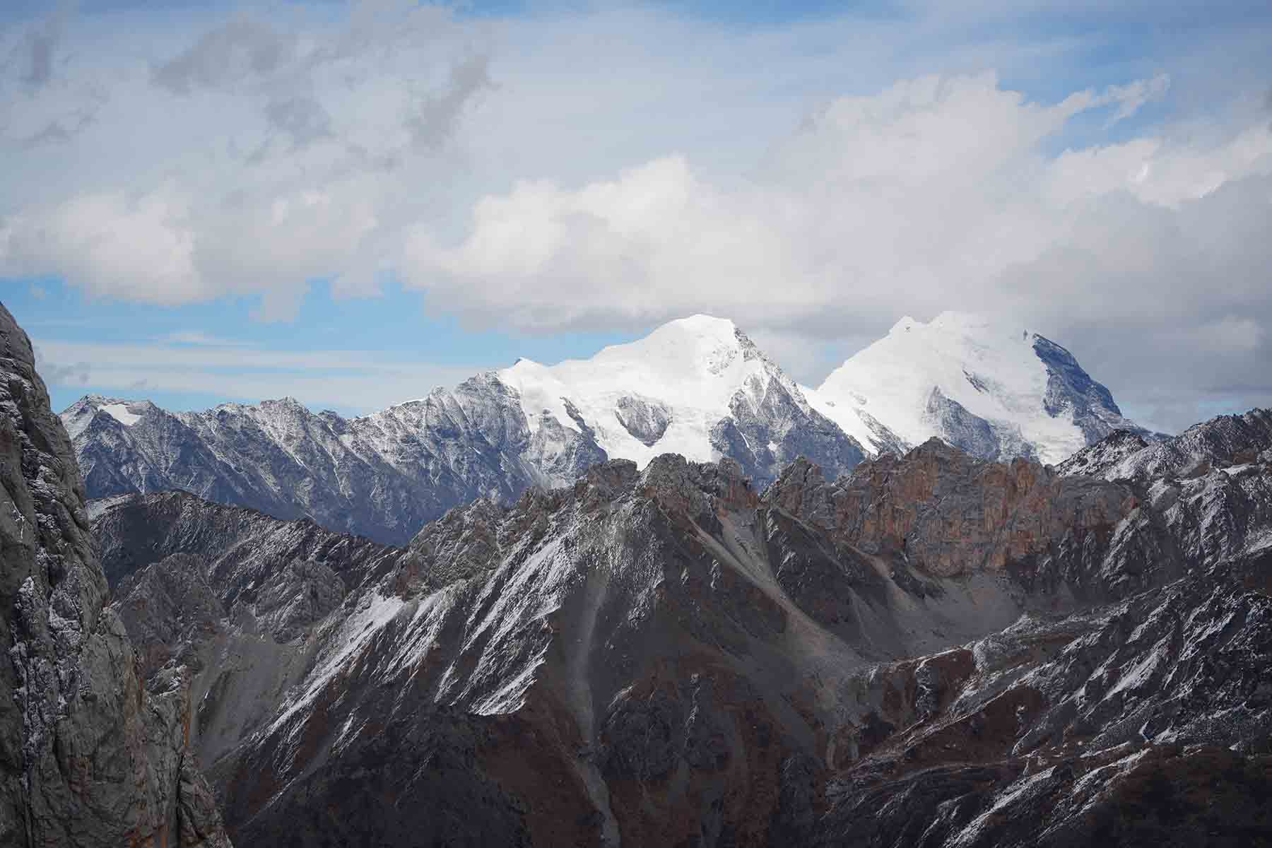
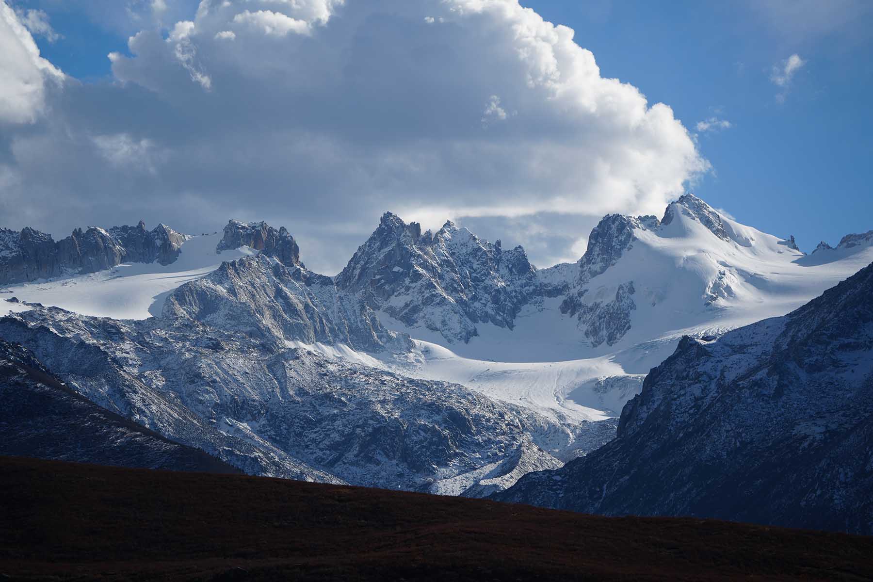
Starting from end of road at 3700m will walk all the way up on steep trail following the ridge line with close view of Gangga Glacier. The walking is not long but steep. We will make stops as we ascend and to take photos of the views. The end of walk is after a long and steep ascent by a prayer flag where the views of mountains are very good. We shall see the Gangga II peak, Zizizo mountain and its surrounding peaks that are around 5500m. We will have a long stop by the end point at 4300m and then walk back the same way.
Summer Plan: 18km between 3700m and 4000m
We will start by road end at 3700m and walk along the river all the way passing by nomads houses and huts, and reach a big waterfall. The walking whole day will be in the valley with views of rocky mountains and walls on both sides. This valley hiking is flexible with distance and time. We are able to turn around at any point especially if weather is not good. River-crossing may be involved today as the bridges may be unreliable in different seasons. We usually do the valley hiking in summer seasons due to more cloudy weather but this is not definite.
Driving 0.5h, total walking 10km 3700m-4300m or 18km 3700m-4000m, medium pace
Overnight same hotel by 3300m
Gangga Mountains
Gangga Mountain Glacier
Gangga Mountains
Gangga Mountains
Gangga Glacier
Gangga in the Mist
Gangga Hiking
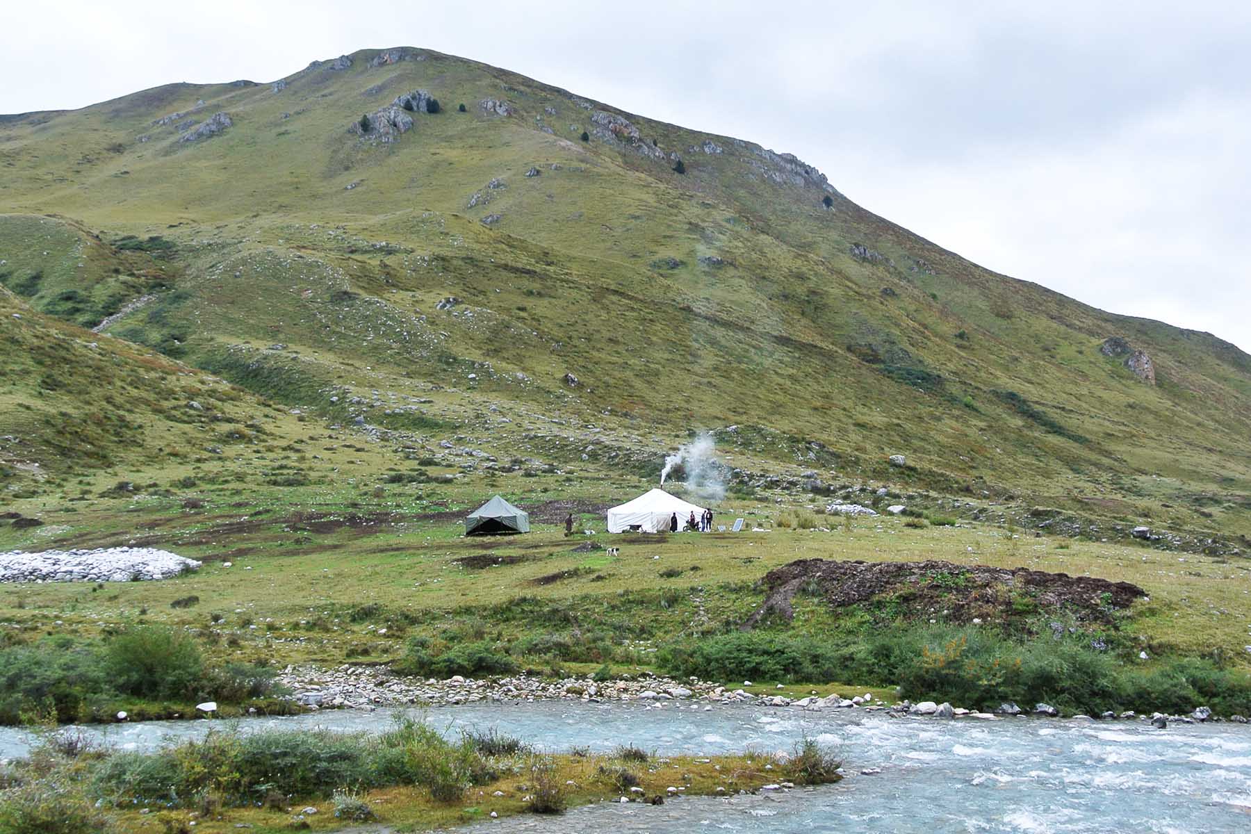
Nomads People
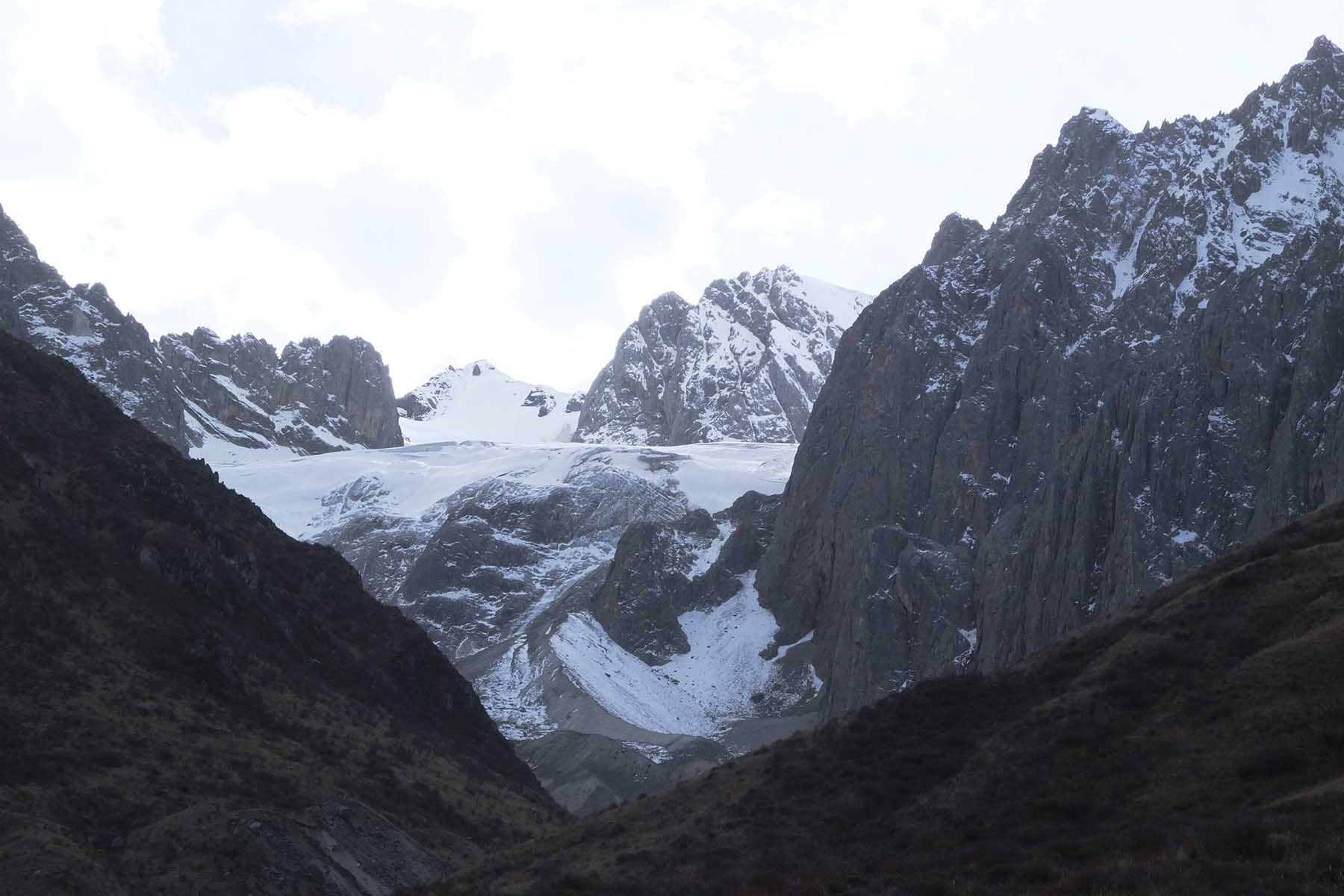
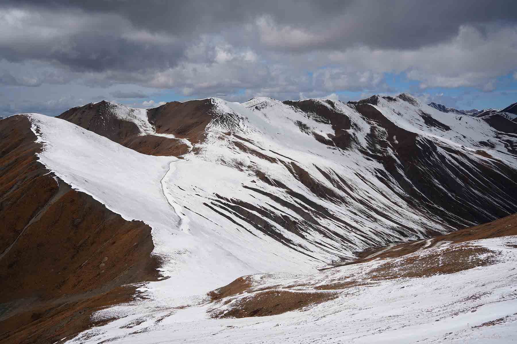
Today we will try a 5000m high point on the mountain ridge to just get to over 5000m and have views of all the big mountains here in this part of Shaluli Mountain Range.
Start from hotel by 9am. (We will give ourselves a bit of time for relaxing as part of the first acclimating days and do not make such trip stressful and suffering if we are not well-acclimated, we can take our time and have enough sleep, eat proper breakfast before we start.) After about 1h drive we get to our starting point at around 4600m (sometimes 4500m pending road conditions) and then walk to a summit for 2km in about 2-3 hours to reach 5025m on snow mountains and ridges. The ridge part is often windy and needs care while walking and some part requires scrabbling.
The views on the top is amazing we will have sight of all the major mountain massifs in this part of Shaluli Range including Gangga Mountains (5600m+), Kawalori Mountains (5900m+), Zhuodala Mountains(5500m+). After reaching the summit of 5025m we will descend back to the car and drive back to the hotel and relax. We should be able to return latest by around 4pm.
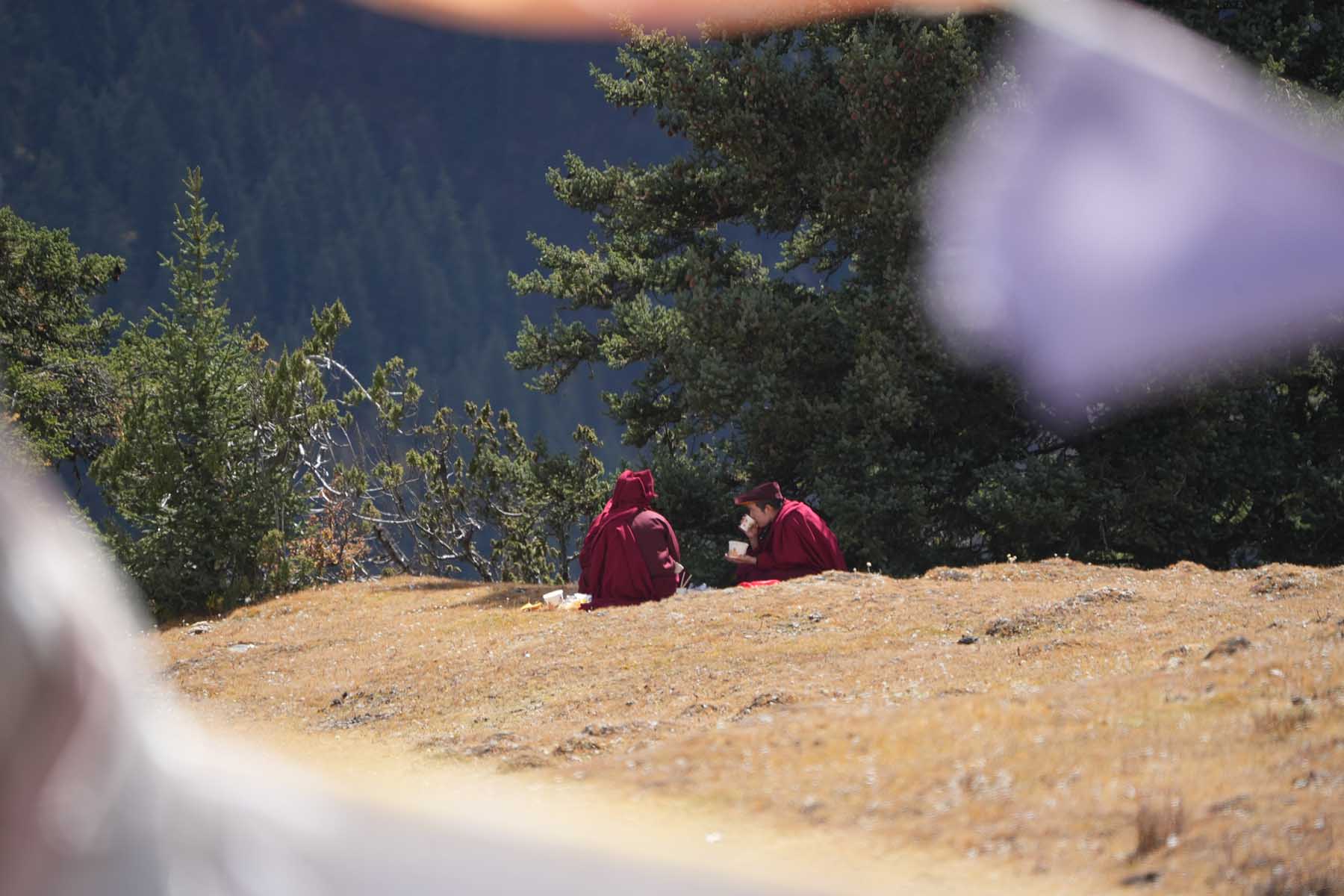
If time allows we will walk the town of Ganzi and see local people and may also go visit the Ganzi Monastery to look into the real traditions and culture of Tibetan monks. If you are a wildlife lover then may consider to walk down the Yalong River next to the town and watch the water birds including cormorants, mergansers, herons, choughs and even vultures.
Total Walking 6km between 4600m and 5025m. Medium Pace.
Overnight in hotel by 3300m.
Zodala Ridge
Gangga Mountains
Gangga Mountains
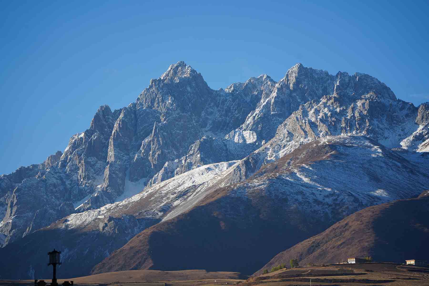
Kawalori Mountains
The Summit
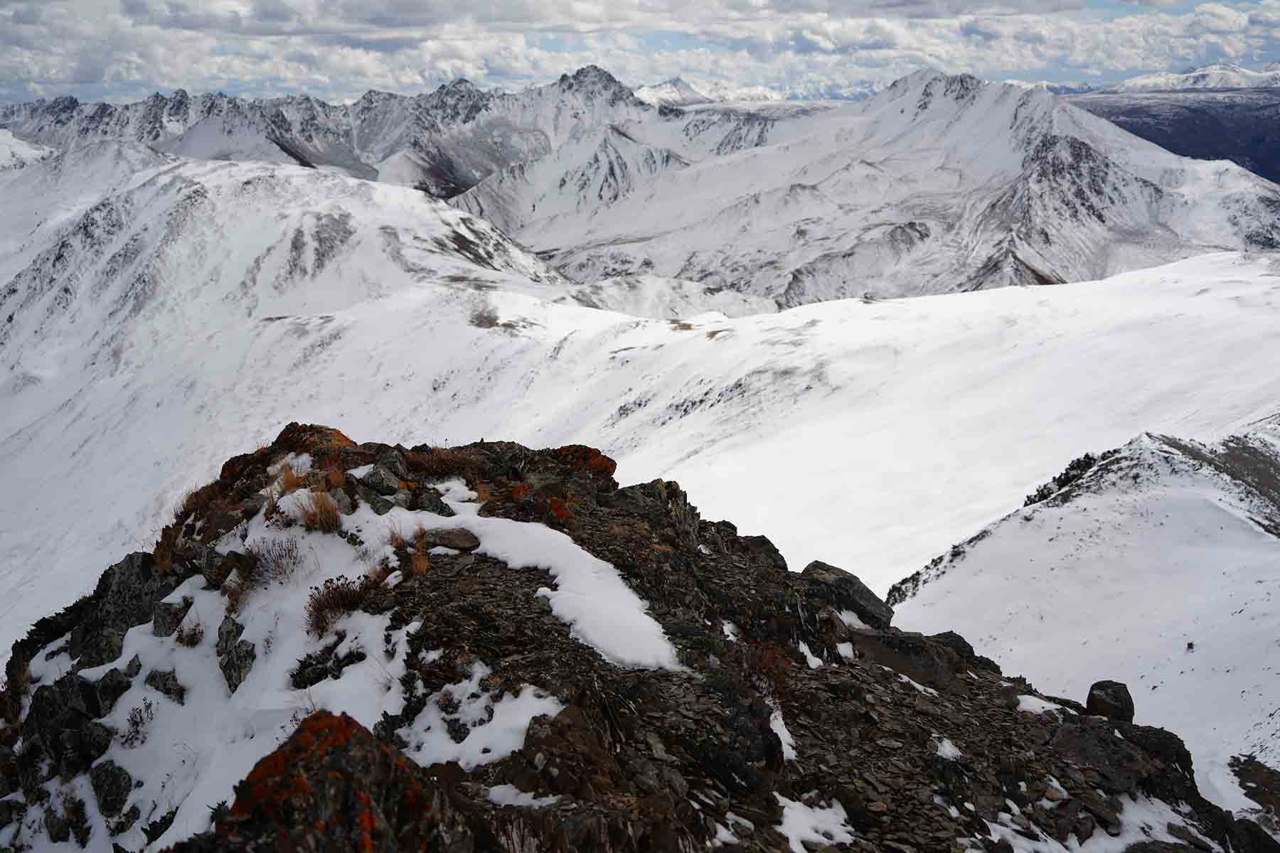
Summit Views
Today we will check out hotel and move to the next place. We will drive to 2 different places and do short walking by each location.
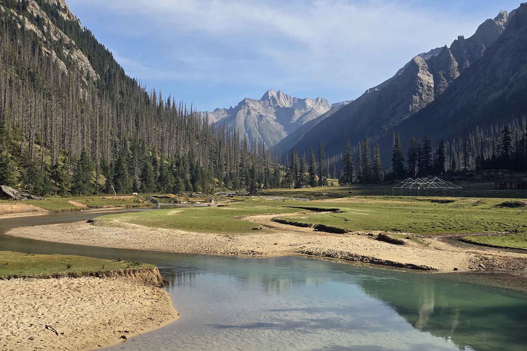
First stop is by Tsotong Lakes that is around 2h drive from hotel. The last part of driving is on mountain unpaved road and can be winding and tricky to drive so we will take our time driving up. The road gets to around 4600m and from there we will have stunning good views of the bigger lakes. Spend some time here just to look at the lakes before we start our 5km hiking up to the small lakes by the foot of the 5100m Red Rock Mountain. The walking is on rocks and grass with elevation gain of total 200m in 2km distance. We will reach the base of the peak by the small lake after around 1-1.5h walking. We will have our lunch break here and then walk back the same way. This series of lakes are called Tsotong Jake Lakes that we may also see other travelers coming here to take photos or having picnic by the side of the lakes but no one does the hiking up to the Red Rock Mountain.
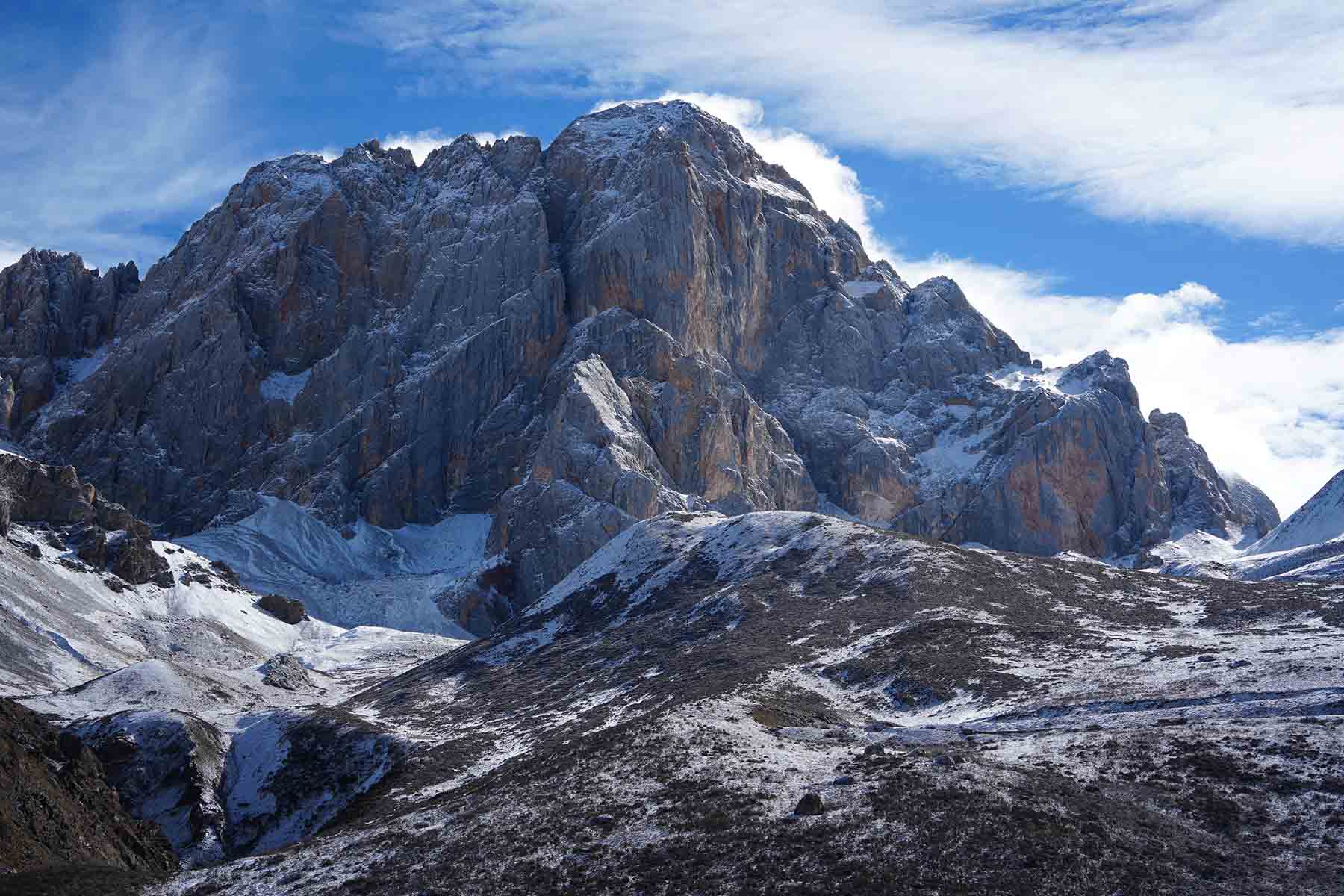
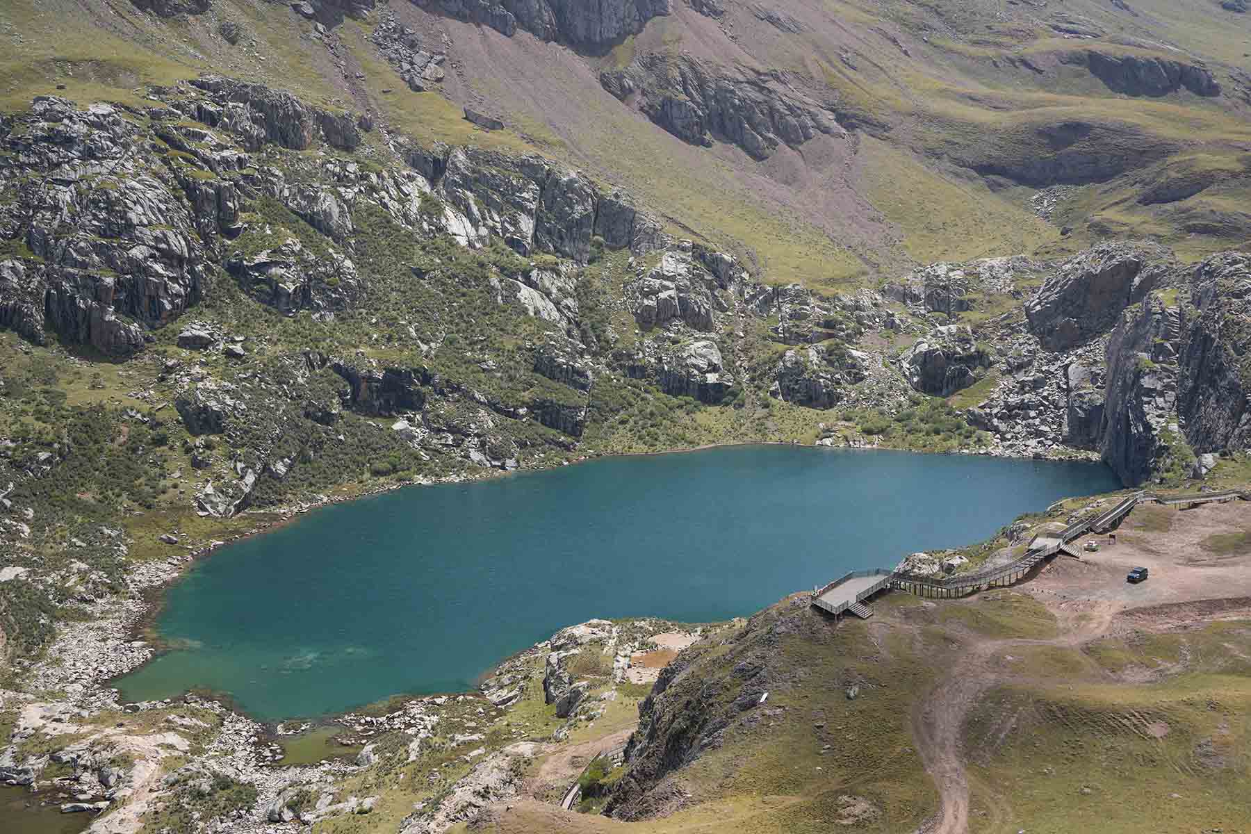
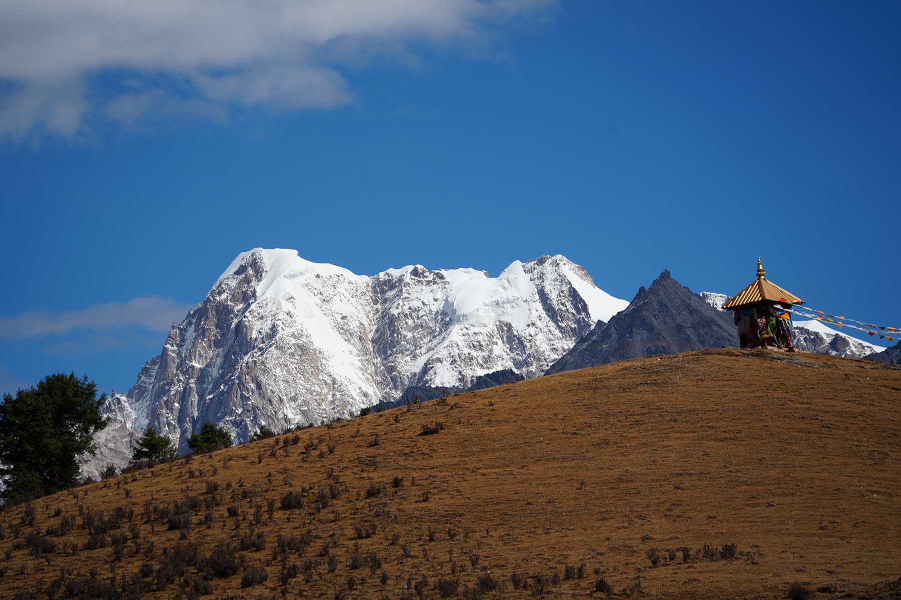
After this we will continue driving 1h to Xinluhai lake, another big lake by the roadside of G317. Xinluhai is called Yilun Latso in Tibetan language. The lake is now a tourist park but few visitors go in to the park. After we check in to the place we will then walk the trail along the lake with views of the highest mountain here: Mt. Chola (also known as Roma Rezha) at almost 6200m. We will walk up the trail above the lake if it’s available and coming back down on a different trail. In a clear day we shall see the big glacier on Mt. Chola and the milky-colored lake of Xinluhai Lake.
Today is also not stressed travel. We will have time to stop if there’s any good views along the way and we will have a relaxed hiking by each lakes. After the hiking we will drive for around 15min to hotel in Manigango, a small town connecting Yushul, Derge and Ganzi in central Kham.
Driving 3h, total walking 5km+5km, 4600m-4800m & 4000m-4100m, medium pace
Overnight hotel by 3800m
Tsotong Lake
Red Rock Mountain
Tsotong Lakes
Gangga West Mountains
Xinluhai Lake
Mt. Chola
Today we will go further west to the very end of Shaluli Mountain Range by the upper Yalong River Basin.
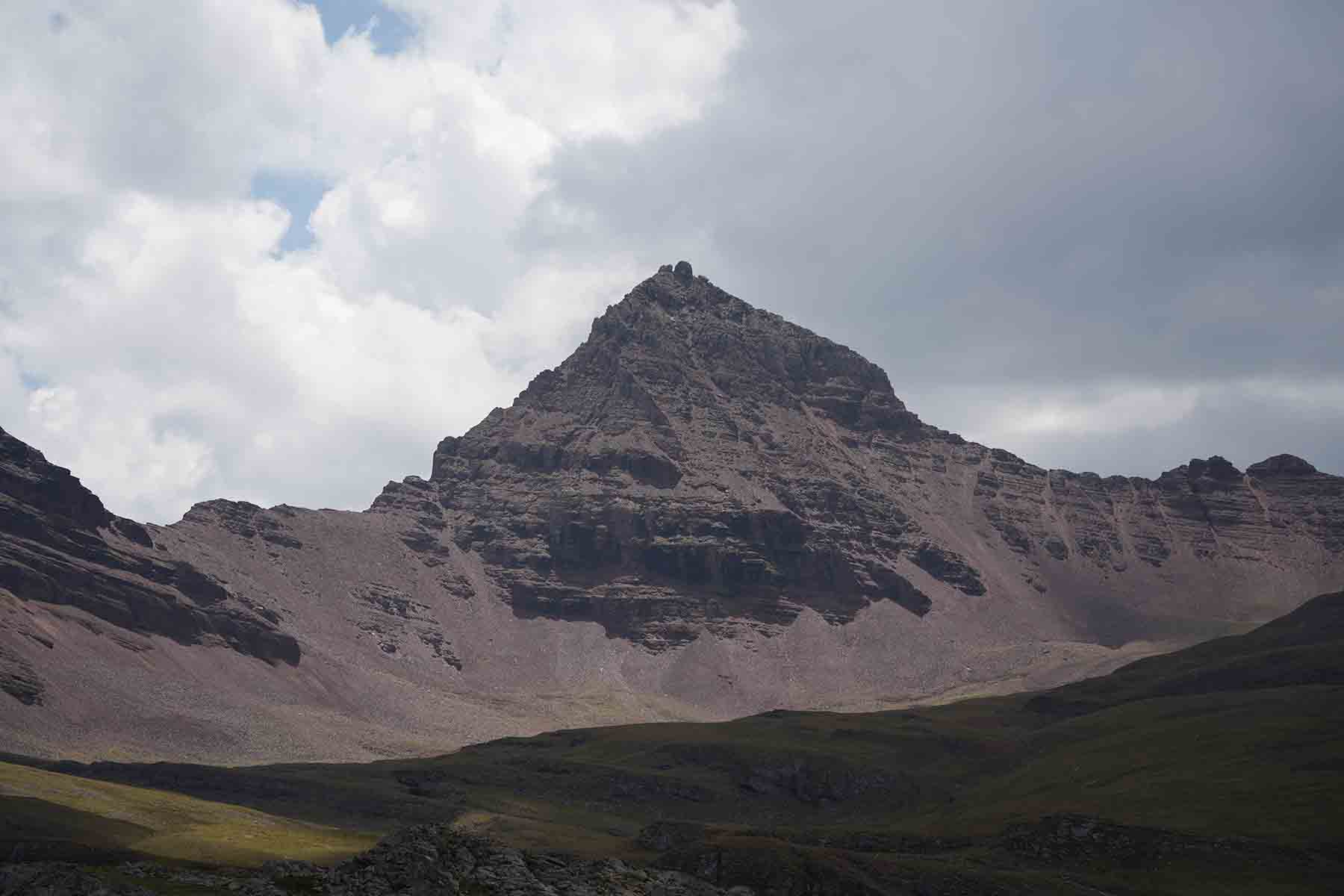
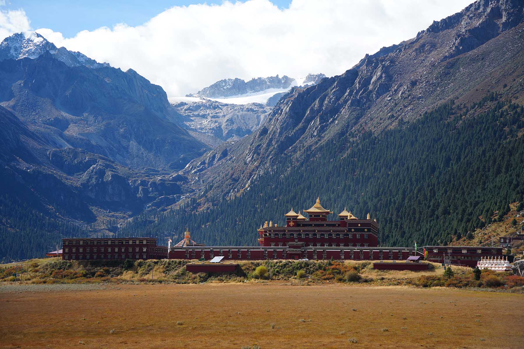
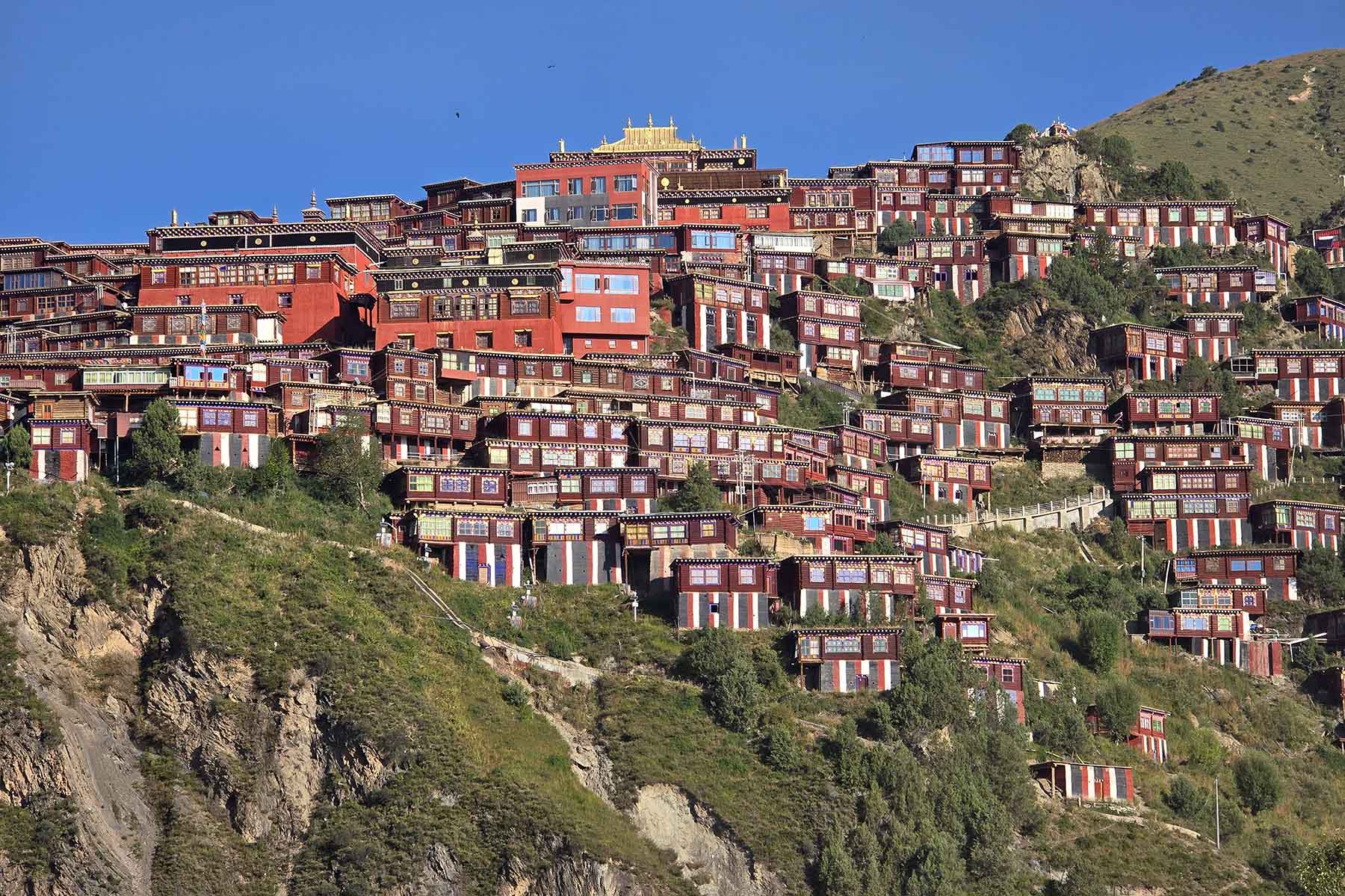
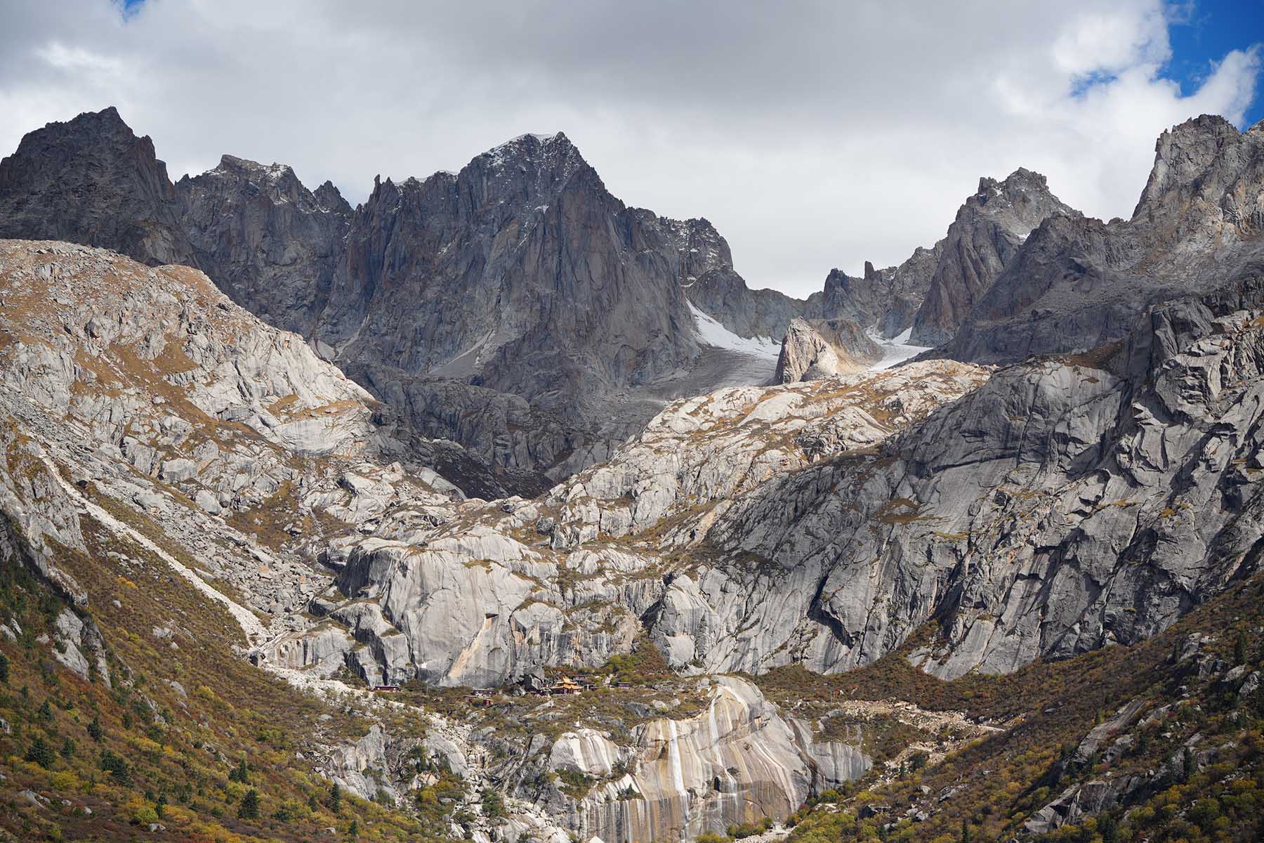
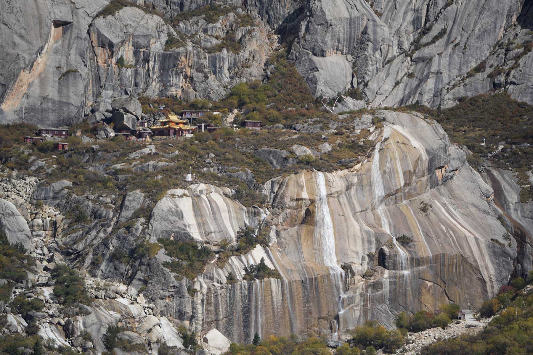
Dzogchen (or Zoqen, or Zhuqing, Zhuqen) is a monastery village located by the west end of Chola Mountain Range north of the Dzogchen Mountain massif. It is a complete monastery town/village that almost no tourist go to.
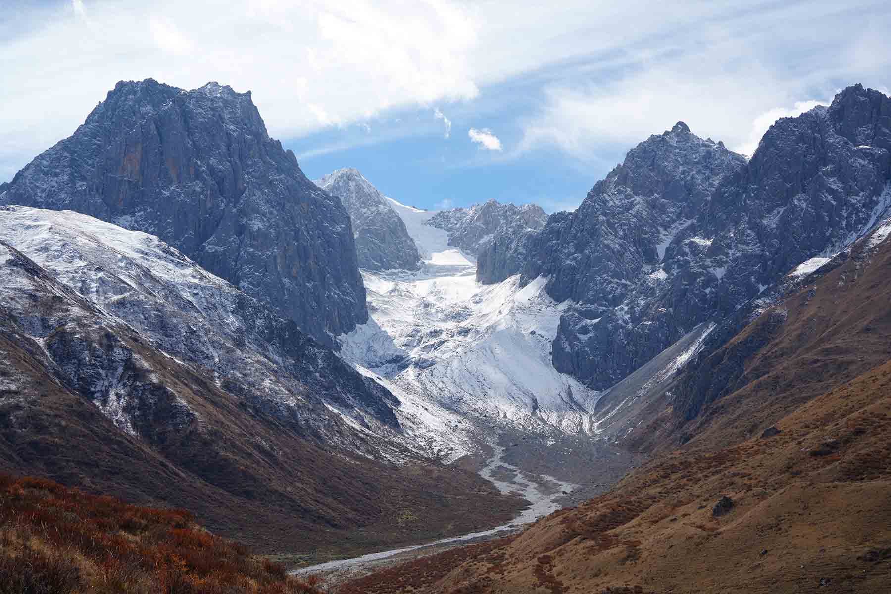
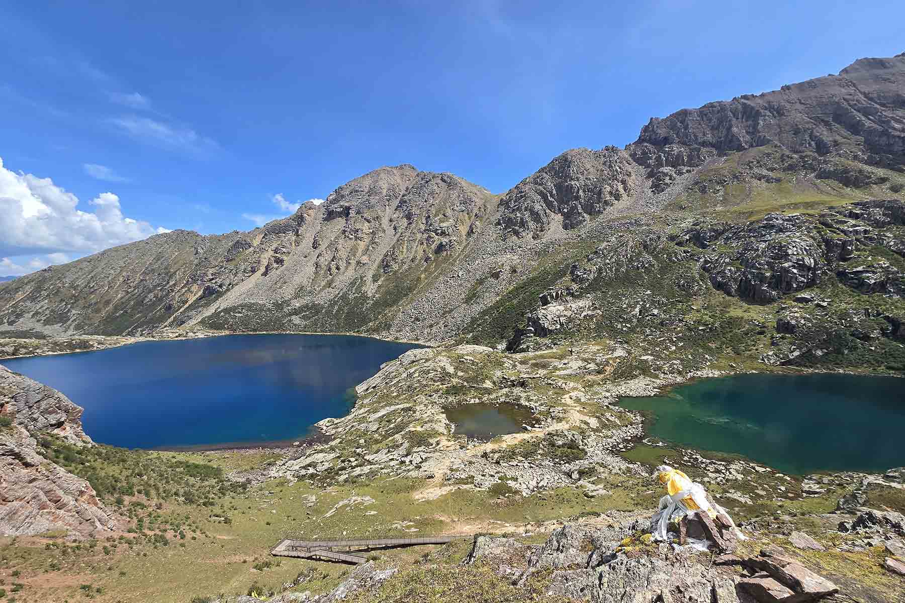
After 40 min drive we arrive the base of the village and we will start our hiking today from the Dogchen Monastery. The walking is half steep and half gradual as we ascend. Our destination is two turquoise lakes hidden in the rocky mountains above the monastery. We will walk from around 4000m to the upper lake at 4600m. The color of the lakes are blue. In a clear day the views are very good. Second part of the ascending from the first lake will be on rocks and when it’s steep can be difficult to walk. Depending on your acceptance level of walking conditions we may skip the second lake and turn around from the first lake after long break there. The Dogchen mountains are not super prominent peaks from the roads and often hidden far behind the lower ranges. Few have really explored this part of the mountains.
After a long rest by the lake we will walk back the same way and have a visit to the many temples of Dzogchen and may even talk to the monks and local people with help of your guide to learn and see local life. Dzogchen Monastery is one of the 6 great Nyngmapa of the whole Tibetan region.
We shall start to drive back no later than 5pm and spend the night by the same hotel in Manigango. En route optional drive to Amtso Lake for a photo stop.
Driving 1.5h, total walking 14km, 4000m-4600m, Challenging pace
Overnight same hotel by 3800m
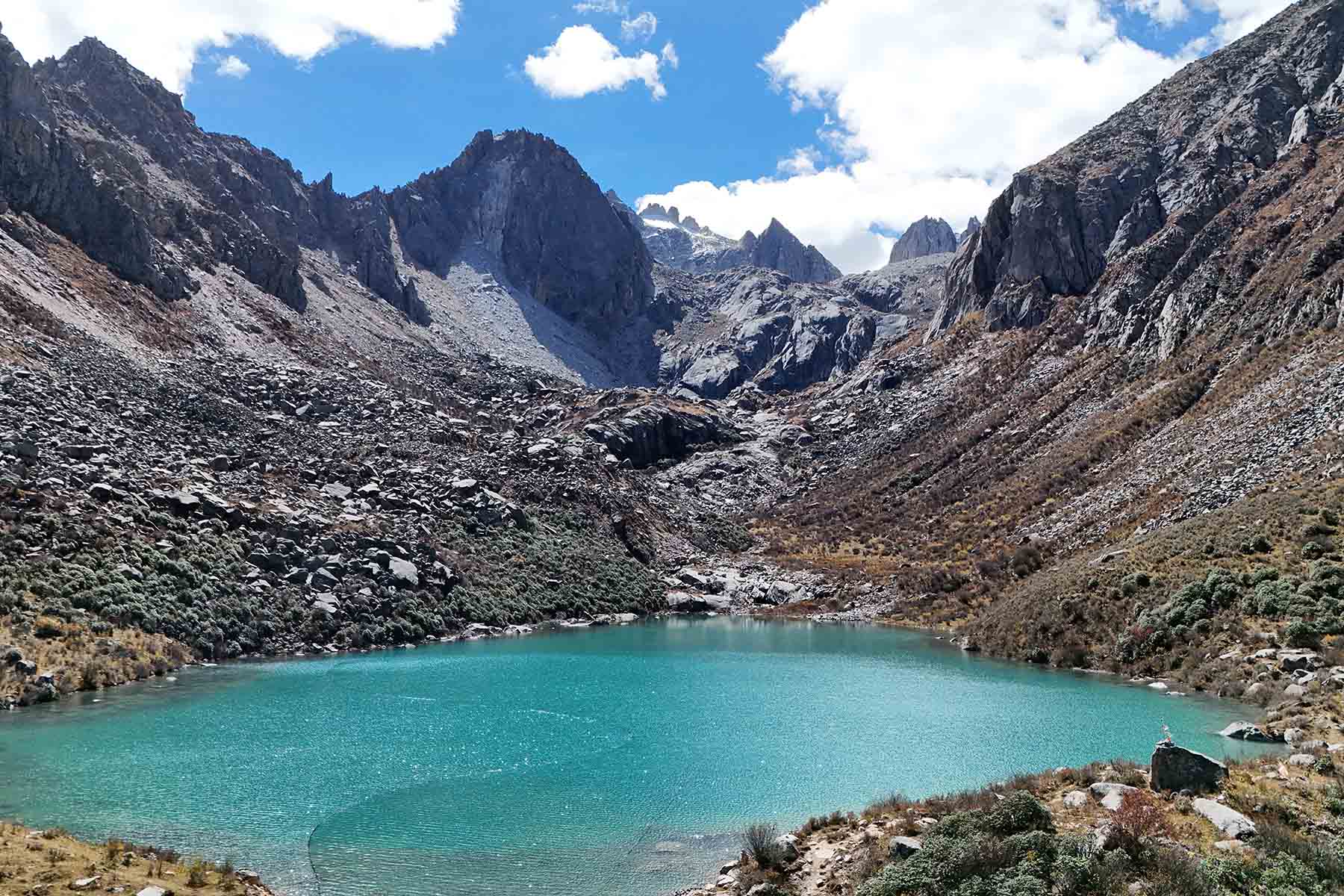
Dzogchen Hiking
Dzogchen Village
Dzogchen Monastery
Dzogchen Mountains
Dzogchen Mountains
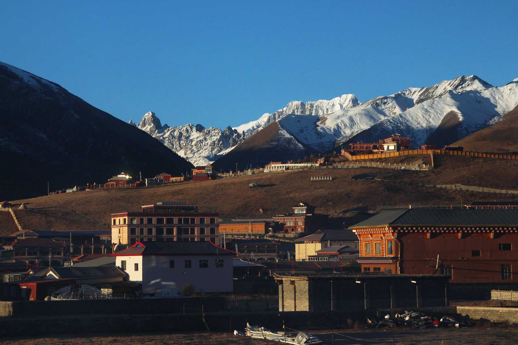
Manigango
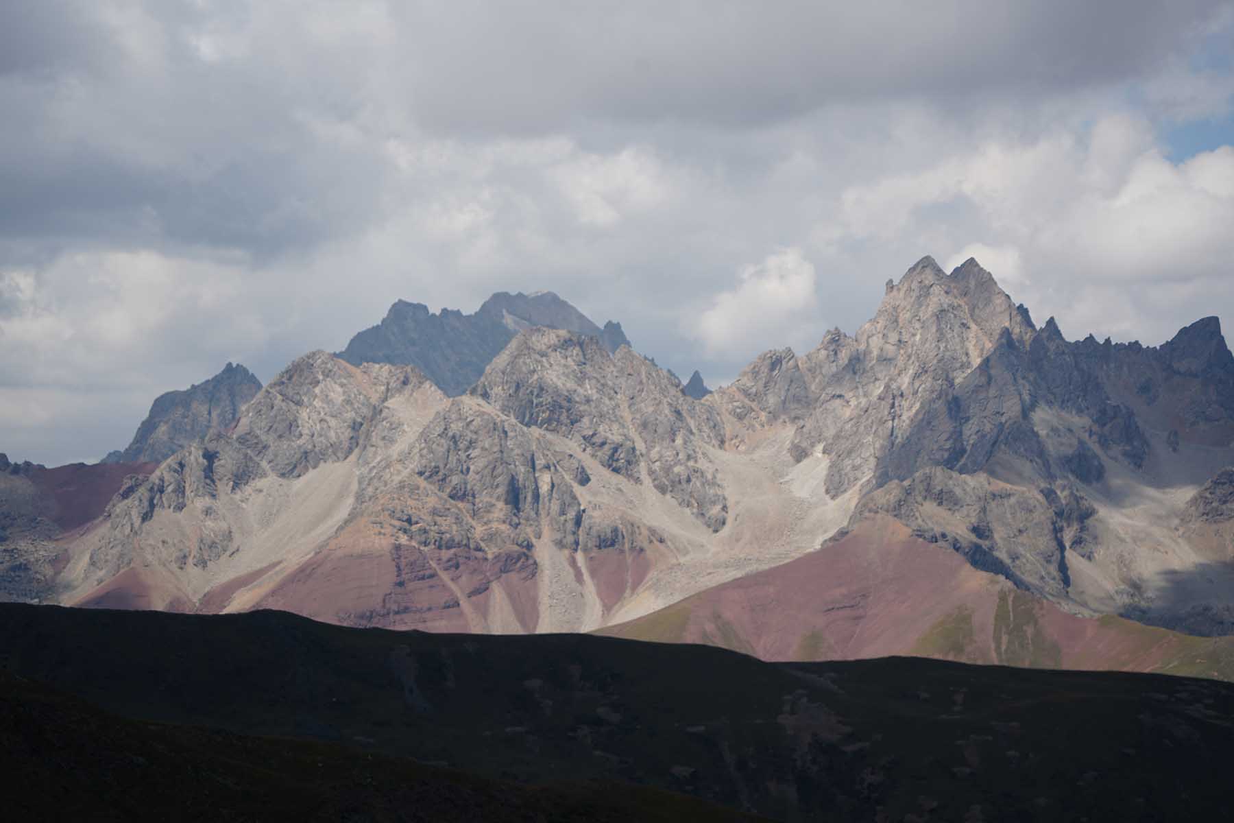
Today we will continue driving into the heartland of Chola from Manigango. In the morning after breakfast we will drive into one of the valleys in Chola Range and have good views of some 5500m mountains along the drive. Over a road pass we will drop down to below 3500m and have warmer weather and into an isolated world of south Chola: Maisu, a land of its own style, full of Tibetan craftsman workshops, glacier water melt into river runs through the village.
After around 2-3 hour drive we arrive the nunnery Gagu and then we will walk the ridge behind the nunnery. Gagu Nunnery is one of the biggest nunneries in Kham and the big cluster of red houses (nun dorms) built on the side of the mountain ridge against the south face of Chola mountains, making a majestic picture of a mystic, real Tibet. The hiking on the ridge is easy and flat. We will walk behind the temple and houses and have views of south face of Roma Rezha and Dopu Rezha (the Chola Mountains) all the time during our hiking. The south part of Chola is less visited and not explored. Today’s plan is to walk from around 4100m to 4300m for around 4km and turn around and go through the nunnery village and pay a visit to the temples if allowed. Today’s walking can be extended to the nomads place that is also used as meditation hut for another 2km depending on the weather and timing. By the end point we will see another peak that is called Dojang Yelong that is 5600m high.
After the hiking and visiting by Gagu Nunnery we will then drive down to the village and check in to our lodge for today. Please note the accommodation here in the village is the most basic one of this trip. The bathroom is shared and the room is traditional Tibetan wooden house. Feel free to walk around the village on your own. The small village has shops and is built on the foot of the Dzongsar Monastery.
Driving 3h, total walking 8-12km, 4100m-4300m, Easy pace
Overnight lodge by 3500m
Chola Heartland
Central Chola Mountains
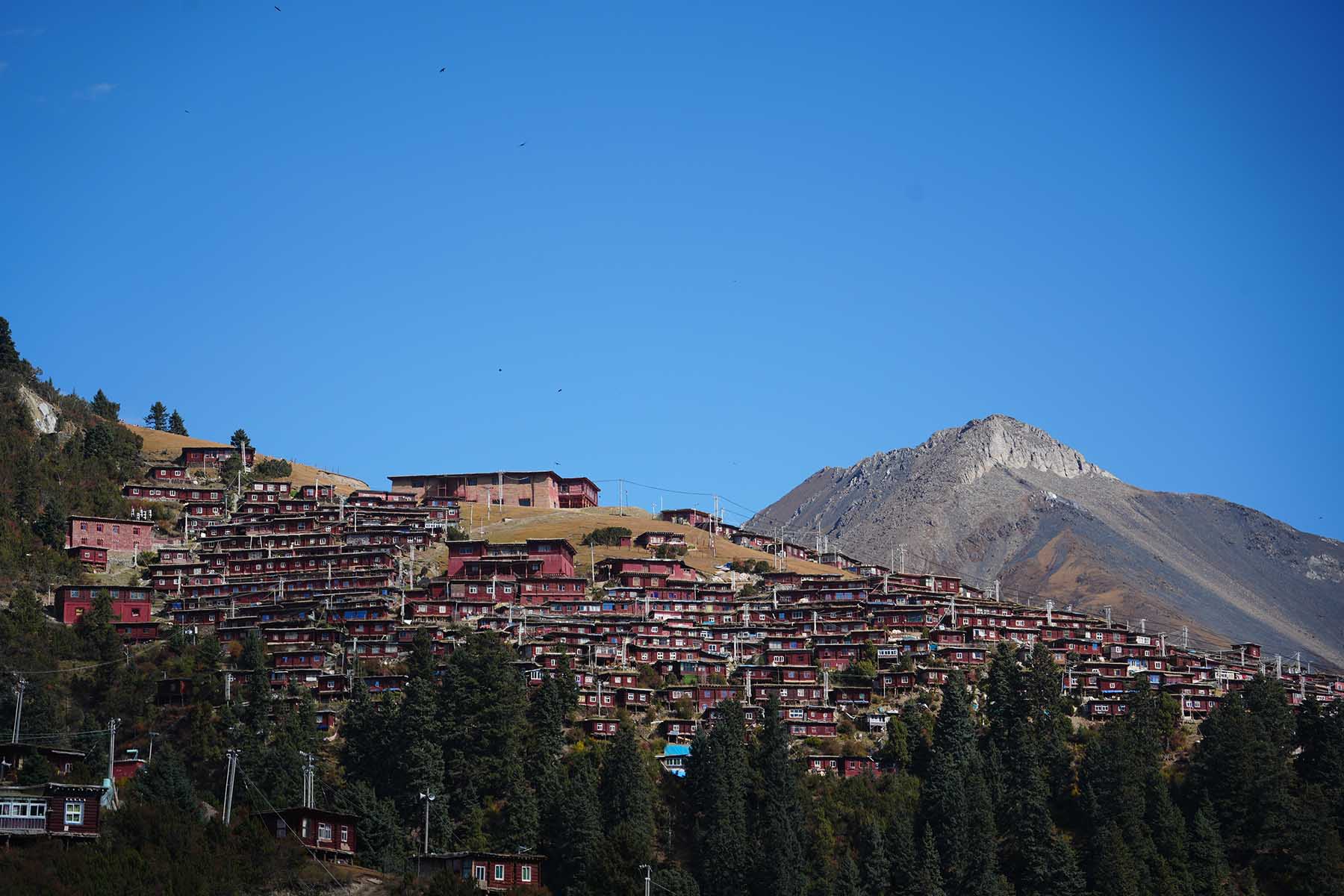
Gagu Nunnery
Mt. Dopu Rezha
Gagu Nunnery Hiking
Gagu Nunnery
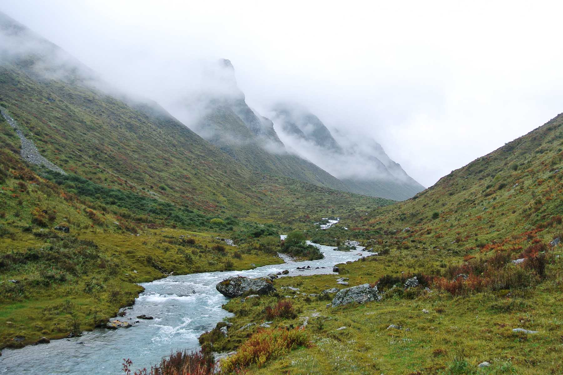
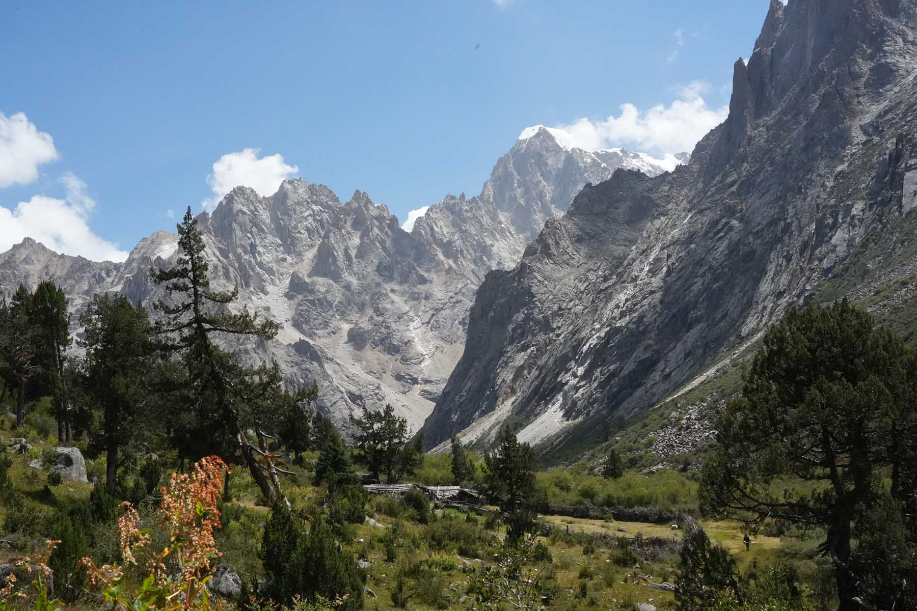
Today is a full day hiking in one of the most remote and most beautiful valleys of the whole China. We will drive for around 30 minute from our lodge after breakfast and arrive the road end and start to walk. The walking is on very gradual and flat terrain along the winding river with sometimes grazing yaks by the foot of forested mountains. We have former hikers have rated this day’s hiking being THE MOST beautiful hiking place they have ever been done. The south/central part of Chola Mountains is not visited by many people because it’s far and remote and not being disturbed by social media and is good to stay this way.
We will walk from around 4100m to around 4200m and then towards the side valley towards the base of Dopu Rezha (6119m) and arrive the base of the side valley. We will have a long stop there to appreciate the tranquility and mountain views before we walk back the same way. Today we shall see other big mountains including Mt. Isjasa(5550m), Mt. Zogang Malong (5800m), Mt. Gayinong(5500m) and Dojang Yelong (5600m). Drive back and stay by the same hotel for tonight.
Driving 1h, total walking 16km, 4100m-4400m, Challenging pace
Overnight same lodge by 3500m
Central Chola Hiking
Dopu Valley Hiking
Central Chola Landscape
Chola Hiking
Today is not a hiking day. We start to drive back to Ganzi Airport from today by going from another road with visits to the significant monasteries including Dzongsar Monastery, Palpung Monastery, and Derge Parkhang (the printing school).
We will first visit Dzongsar Monastery. It was first built in 8 century as a Bonpo Temple and then was converted into Sakya later in 13 century. It has monks over 500 and was destroyed in 1958 and then rebuilt in 1983.
Then we will drive for around 2 hours to Palpung Monastery. It is a Tibetan Buddhists' monastery first established in 1729 in Qing Dynasty. It is a big monastery in a back-country valley southeast to the town of Dege(Derge). It was built on a mountain platform in the alpine valley. Constructions of Palpung Monastery are immense.
After this we will continue drive to Derge for 1h and visit the Derge Parkhang, Derge Sutra Printing Temple, is the institution printing and preserve Tibetan Literature and Buddhist's works. It is an important cultural and historical centre in Tibet. It is renowed as "the encyclopedia of Tibetan culture" or "Cultural pearl at the foot of Snow Mountain".
Then we will continue drive to Manigango for another 1.5h.
Driving 5h, visits 4+h, easy pace
Overnight hotel by 3800m
Dzongsar Monastery
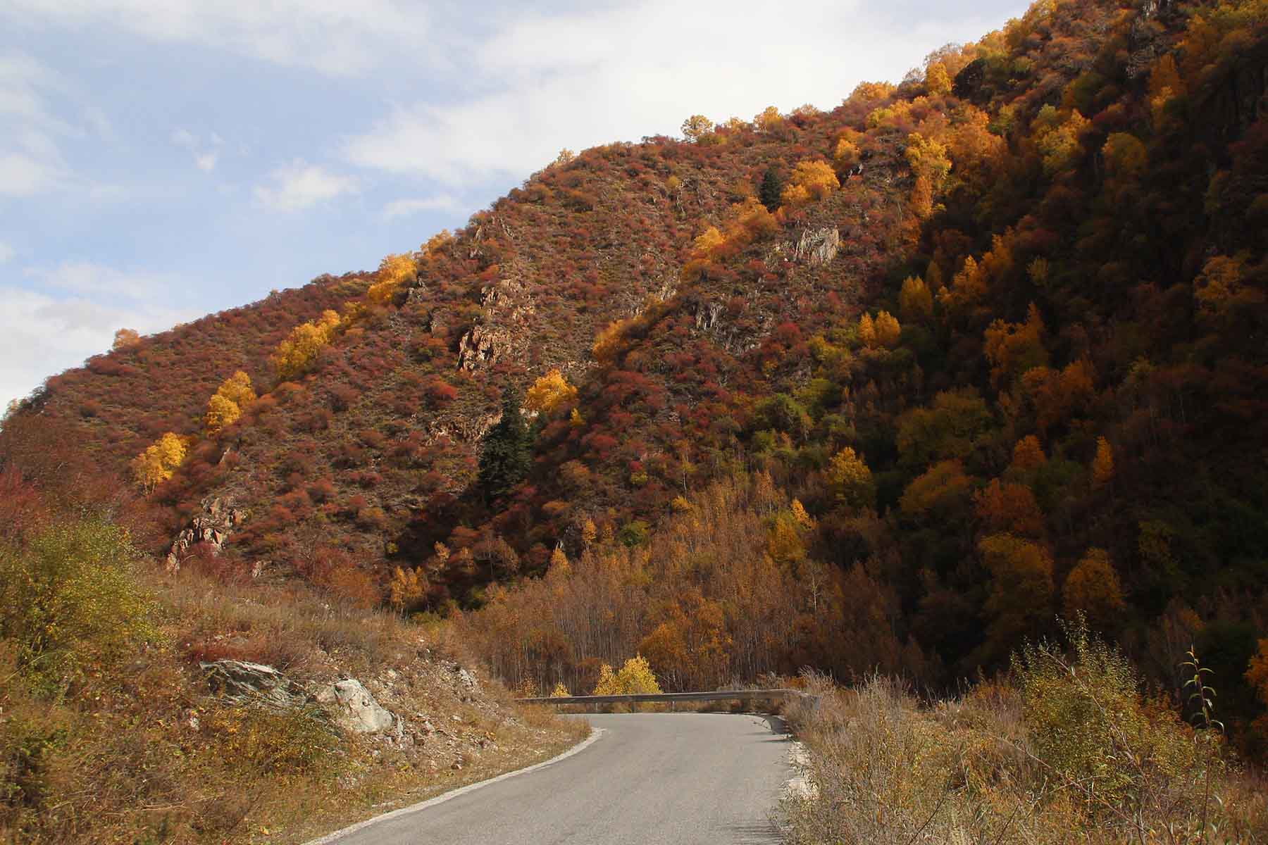
Chola in Autumn
Chola Mountains
Monastery over Rock
Today we will drive straight to airport of Ganzi and you will then catch your flight back to Chengdu. Tour ends.
Driving 1h, easy pace
This tour is customizable regarding tour days, places of interests, accommodation level where available, etc.
This trip is available all year round but best seasons include April to November. Winter is cold but still doable.
All places in this trip are wild and un-touched, you won't see another visitor or even other humans.
This adventure involves walking at over 3500m. Precautions for mountain sickness are necessary.
Traveling to the listed places will expect lower standard services at hotels and restaurants even if they maybe the best choices. The service level is not as up to what you have in places like Chengdu. The hotel people don't speak English nor do the people from restaurants. These places are quite far, wild but beautiful. As authenticity comes often with less comfortability. Public Toilet can be really bad. You are always recommended to use your toilet in your hotel while you don't want to use the public toilet or do it in the open wild. You are recommended to have toilet paper with you. Food are with limited options at most of the places.
This tour involves walking at high altitude at over 3500m, people with cardiac-related conditions, cerebrovascular disease, hypertension, arrhythmia, respiratory diseases, obstructive pulmonary diseases (bronchial asthma, bronchiectasis, emphysema, active tuberculosis, pneumoconiosis), pregnant women and people who have been diagnosed with high altitude pulmonary edema, high altitude cerebral edema, high altitude hypertension, high altitude heart disease, and high altitude polycythemia are not recommended to do this trip.
Please complete the form below and submit it. Our team will contact you within 24 hours after receiving your inquiry.