This article is about travel information of Changping Valley of Siguniang Park. It is information we have gathered from our experiences working there since 2013. It includes tickets and permits information as well as hiking and camping information.
Changping Valley is one of the three valleys(parks) of Siguniang. It is the one in the middle of the three north-south paralleled valleys. Changping Valley is total 28 km from North to South. Its entrance is by Changping Village by Upper Siguniang Tourist Center by the east end of Rilong Town. Changping Valley has views of mountains, well-protected forest, a river running through the valley, small glacier, highland lakes.
 By the pass over Kazigou to Bipeng
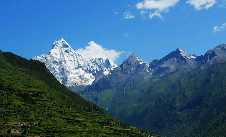
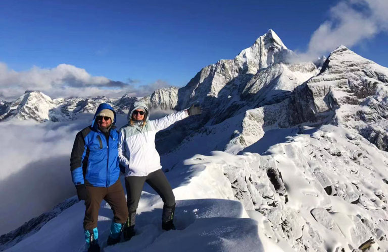
A lot of visitors to Siguniang may have seen the South face of Yaomei peak, the highest mountain of siguniang that is usually referee to as Mt Siguniang itself. But every visitor that comes to Siguniang will have the chance to see the West face of Yaomei Peak which is also amazing and at a much closer range. Please note you can only reach Muluozi to see the rock face of Mt Siguniang. Anywhere below Muluozi you won't see it.
 Yaomei Peak West
The West face of Yaomei is a massive almost-vertical wall located right by Muluozi of Changping Valley. Mt Siguniang is a difficult mountain to climb, partly because of it's steep sides especially the west face that few has ever tried.
Normally for people who have been to Siguniang and have visited all three valleys would agree that Shuangqiao has the most mountains in number. Shuangqiao has around 25 mountains that one can see while Changping has around 20 mountains. So it's not too much less mountains that Changping has than Shuangqiao. Although because in Shuangqiao one can easily get to end of the valley by bus and see all the mountains while in Changping Valley people normally only get to Muluozi where it's only half way to the end of the valley therefore only see half of the mountains in Changping valley.
Mountains of Changping by lower parts at Muluozi and below include Mt Shuangfeng, Mt Riyue Baojing, Mt. Pomiu, Mt. Sanfeng, Mt. Camel, Mt Yangmantai, Mt Siguniang Yaomei, peak 5700, etc.
 Mountains in Changping Valley
 Peak 5700m
 Mt. Pomiu Westface
 Mt. Siguniang Westface
 Ice-climb in Changping
 Mt. Camel and Mt. Yangmantai
 Mt. Se'erdengpu Westface
 Mt. Yaomei NW
 Mt. Chibu
 Mt. Pomiu Northface
 Rainbow Peak Eastface
 Mt. Pomiu Southface
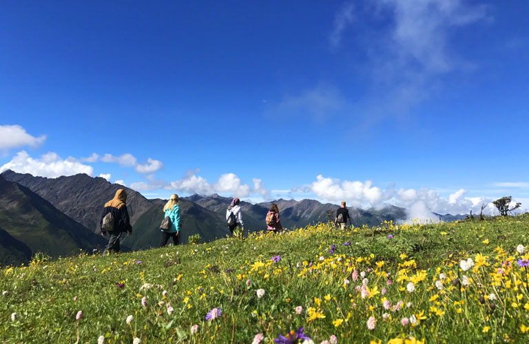
For visiting one needs to start by the tourist center and use a bus for around 10 minutes to get to Lama Temple and start to walk or hire a horse from there. Changping Valley has no roads after the temple so if you don't wish to walk or ride horse this park of Siguniang is not recommended to you. Changping Valley is good for hiking and camping.

There are two trails in Changping Valley before Lower Ganhaizi: one is well paved boardwalk and the other is horse trail. The boardwalk is clean, easy to recognize and used by most hikers and visitors who are not riding horses. The horse trail is forest trail with some rocky sections and during rainy /snowy days muddy trails, and also easy to recognize. The horse trail is only used for horse riders and local people but if you prefer more authentic mountain trails you can also walk on the horse trails.
 Hiking Changping in Winter by Kushutan
 Mt. Shuangfeng in Snow
Changping Valley is total 28km but one normally can't do it in one day. It is usually the same wat hiking in and the same way hiking out. If you want to do a "walk through" hike, read here Changping to Bipeng Hiking. Normally for fit hikers we recommend you to reach the 10km point where the views are quite different from anywhere before this point. This means you will walk for around 20km total. Please note if you don't wish to stress yourself too much you can turn around anywhere before the 10km point because views are also beautiful. Given that sometimes weather is not good enough to provide clear views of the mountains, you may choose not to reach the 10km point since views won't be much different. For anyone who wishes to go beyond the 10km point you are recommended to camp for overnight in order to go further. There are no hotels in the park.
 Mt. Siguniang in Morning Glow
Muluozi
 Overhanging Ice
Changping is a medium level hiking place of Siguniang comparing to the other two valleys: Shuangqiao is a even more medium hiking while Haizi is a hard walking.
The walking trail is not steep and the first 7 km is well-paved boardwalk. Walking for around 10km into the valley one can reach Muluozi, the foot of Mt. Siguniang by its west side. Views of Mt. Siguniang from its west are totally different from that of the south. It shows you the big steep wall of this big mountain. After Muluozi, one can keep walking further for around another 10km to Chazi Gou, where the trail splits into two: the one goes to the north is to complete the popular Changping to Bipeng Hikingand the trail goes to westward is to reach the end of Changping Valley and go further over the pass to Shuangqiao Valley.
 View by Kazigou Camp
 Above Kazigou Camp
 Looking North to Bipenggou Valley
The 10-minute tourist bus is not obligatory however it saves you 2 hours of walking on the road from ticket office to Lama Temple (enter to the trail). So the bus is necessary and usually sold together with your entrance ticket.
If one wish to go as far as possible in one day, you are better to start early and normally you can reach Muluozi where the views are very good. If you only have half day or less then you won't get too far and views are also good but not as good as after 7km (End of Boardwalk). Although you can always ride horse to save time. Normally horse-riding is faster than hiking. So please plan carefully with your visit to Changping.
 Changping Valley Lama Temple
From Lama Temple to Lower Ganhaizi there are two separate trails one is boardwalk and the other is horse trail. These two trails will merge by Lower Ganhaizi where the boardwalk ends. From there it is mountain horse trail all the way. The boardwalk is 7km from Lama Temple to Lower Ganhaizi. From Lower Ganhaizi it is 3km to Muluozi, the 10km point. From Muluozi to Kazigou it is around 10km. From Muluozi it is horse trail all the way to end of the valley. The trails are good trails and easy to recognize. Some part of the horse trail maybe a bit rocky but okay to walk. Some trails above Muluozi maybe muddy during summer season. After Muluozi there is a split of trails. One goes to north to the pass to Bipeng Valley, the other continues westward to end of the valley that few people go there. The trail goes up the pass is very steep but safe to walk. There are handrails for the steep part. Horses can not go up the pass therefore everything has to be carried by humans. The trail down to Bipeng after the pass is also very steep. And it is the north side (Shady side), making the hiking in snow season impossible.
The walking is basically on very gradual ascent or flat terrains. Elevation is from Lama Temple at 3450m to Muluozi at 3650m and to 3850m at Kazigou. The pass to Bipeng is at around 4500m.
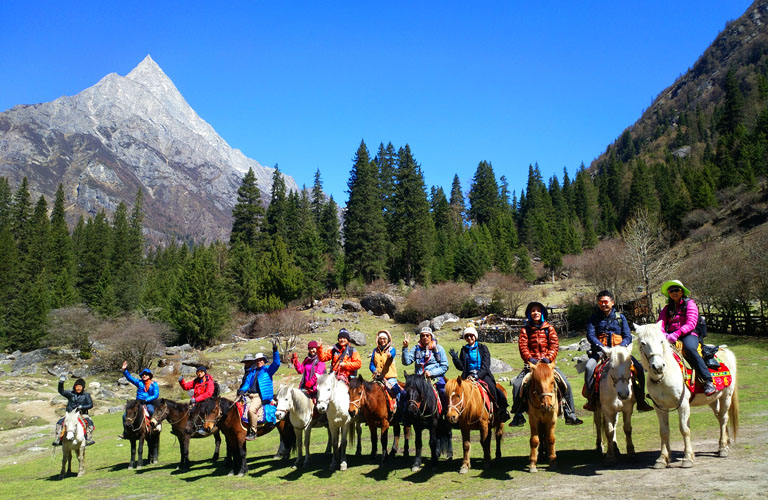
Horse-riding service can be found by Lama Temple after you get off the tourist bus. The horses are Tibetan horses and not very big. When you ride the horse, a horseman or horsewoman will be leading the horse and tell you the safety tips about riding his/her horse. Riding a horse will not use the boardwalk but the horse trail on the other side of the river opposite to where the boardwalk is. Normally a horse is rented by the entrance of Changping Valley by Lama Temple. If you wish to hire a horse halfway it is usually not available but because local horsemen always want to get more business so they often use their extra horse and try to do more business. Hiring horse outside of the horse station by Lama Temple usually involves waiting and prices can vary.

This valley is at the elevation bettween 3400m and 6250m. The walking trail is between 3400m and 4600m. At Lama Temple it is at 3400m and at Muluozi the altitude is around 3700 meters. At Chazigou it is around 3800 meters. The pass to Bipeng Valley is at 4600 meters. The walking trail is quite gradual and no steep ascents or descents except the path to the pass. It is basically comfortable walking if you are not going over the pass. Between Lama Temple to Muluozi it is around 10km.
 Changping Valley Muluozi
 Changping Valley
 Changping Valley Mount Pomiu
 Changping Valley Chazigou - End of Valley
 Changping Valley 4600-m Pass
Camping is allowed in the valley, but a 150 yuan per person is required and need to be sorted before you go into the valley. Huts can be found at Muluozi and there is also a guesthouse available. This guesthouse provides shelter only not rooms. You need to bring your own sleeping bag. A bunk at Muluozi costs 100 yuan (price in 2021) per person. Good camping sites include Lower Ganhaizi, Upper Ganhaizi, Muluozi and multiple places above Muluozi.
 Temperature drops below -10C during winter.
 Waiting Sunrise
 Sleeping in Cave feels warmer than in Tent
Entrance Ticket: 70 yuan per person for high season (Apr - Nov), 50 yuan per person for low season (Dec - Mar); an extra 150 yuan required if staying overnight in the valley.
Tourist Bus: 20 yuan per person (Necessary).
Optional Horse-riding:From 380-480 yuan depends on how far you go into the valley
Working Hour:All Day (the park normally open after 7:30 and the tourist bus normally stop running by around 17:30 everyday).
Trails Underfoot:First 7km boardwalk, the rest horse trail.
Recommended Time to Spend:1 -3 Day

Route: Chengdu - Mt.Siguniang - Chengdu

Route: Chengdu - Mt.Siguniang - Chengdu

Route: Chengdu - Mt.Siguniang - Lixian - Chengdu