

Price: upon inquiry
Destinations Visited: Kangding (2 nights) , Camping (4 nights), Tagong (1 night)
Departure: Private Tour / Flexible Date
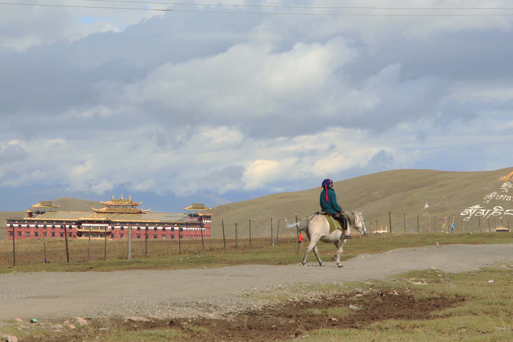
Kangding 8 days hiking is a perfect family-friendly adventure trek in Sichuan. It starts in Chengdu and visit the Tibetan town Kangding. The hiking is in the valleys of primitive landscape and beautiful lakes and mountains where less people have visted. It ends in Tagong, a Buddhist town of Kham with stunning Buddhist constructions and interesting local Tibetan people. This is truly an adventure into the wild Sichuan.
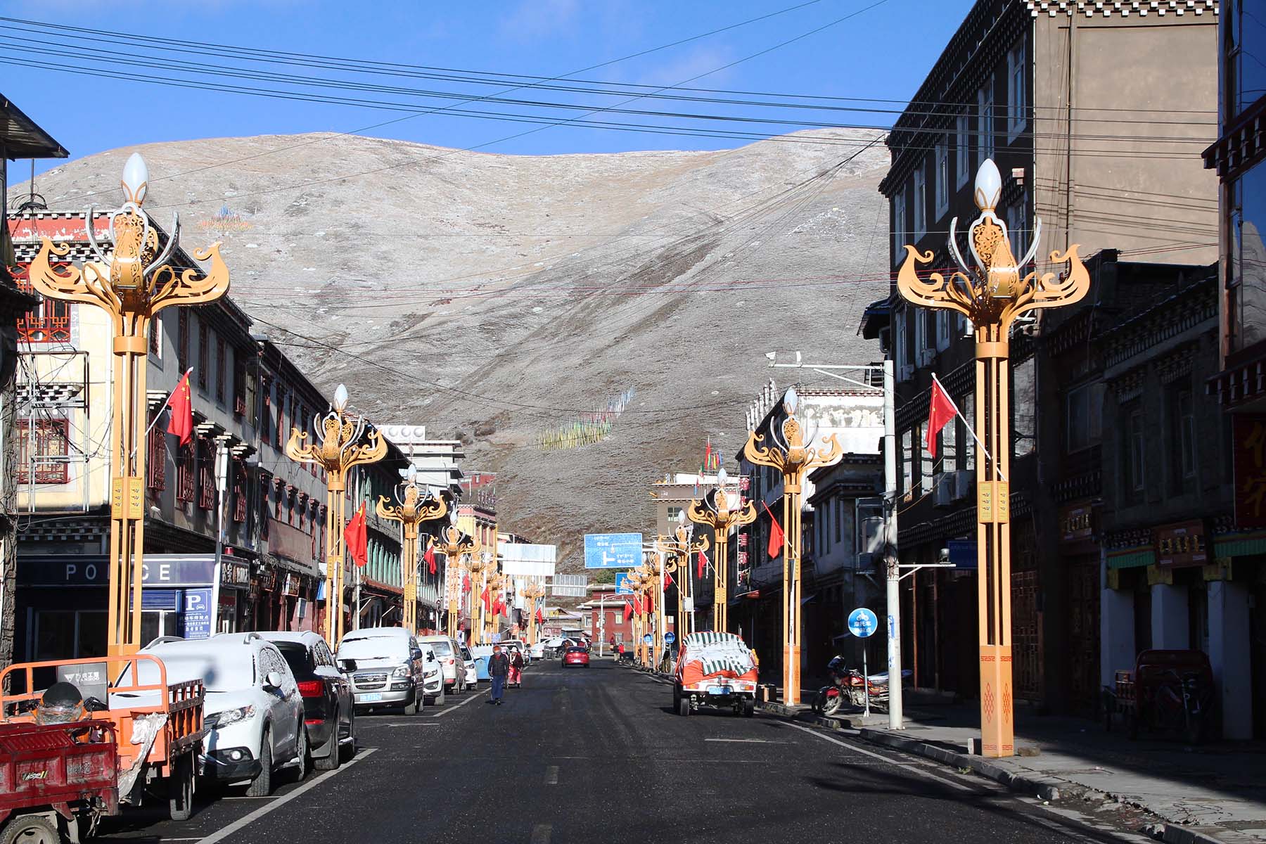
Book NowStart from Chengdu and drive for around 3-4 hours to get to Kangding. We will use the new highway between Yaan and Kangding that was built in 2018. The total drive is around 280km. We will make stop along the way for toilet break and lunch stop. In the afternoon after arrival we will drive up to the road pass by Yajiageng and have acclimating walk up to the lake and try walk to over 4000 meters for better acclimating. This is oreintation walk so try not to stress yourself but rather slow down and enjoy the fresh air and beautiful views while walking. You will gain amazing views of mountains and gorges while hiking by the lake near Yajiageng. We recommend to spend around at least 2-3 hours by around 4000m. After the walk drive back to Kangding and check in hotel. Feel free to explore the town of Kangding at leisure. Kangding is a mixed Tibetan and Chinese town with modern things available. You can choose to walk around the river that runs through the town, or watch the dancing people by the central square or do some shopping by the shops for next days supplies. Have good rest and prepare for the next day's activity.
Total Walking 4km between 3900m and 4000m. Easy Pace.
Overnight in hotel by 2600m.
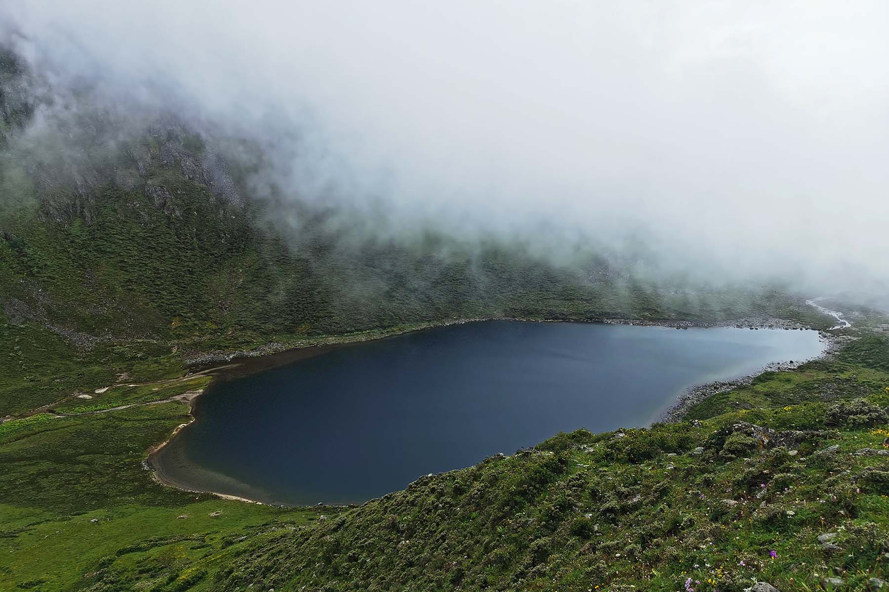
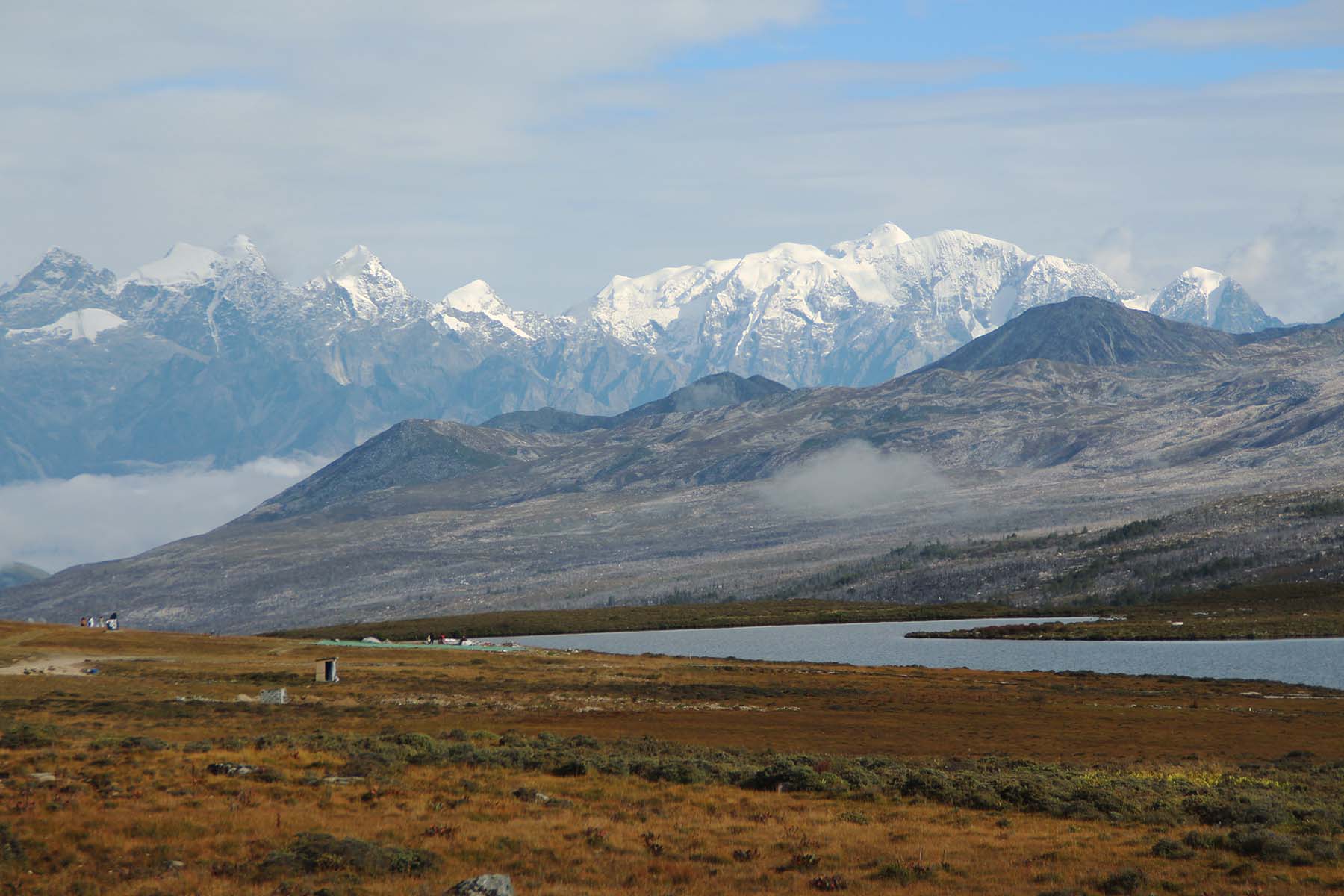
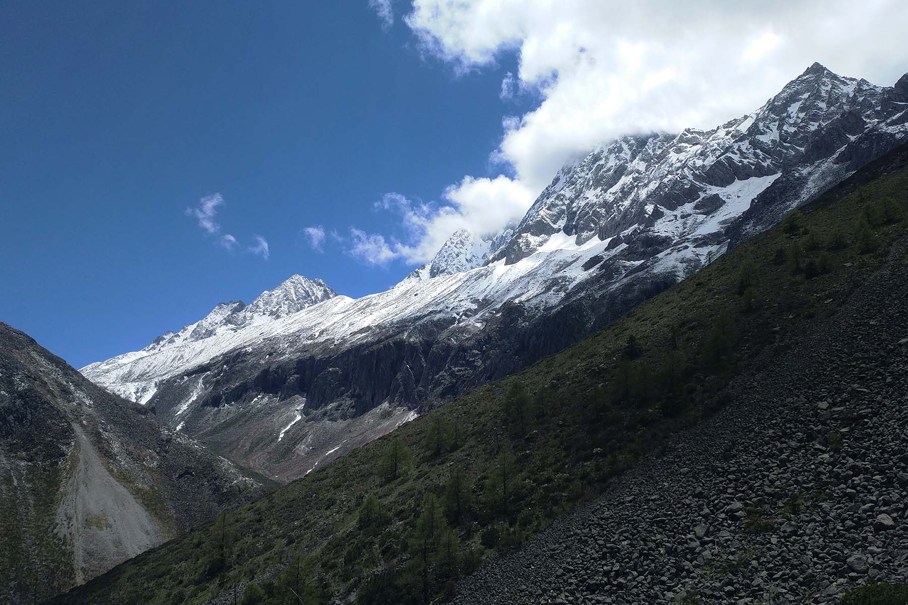
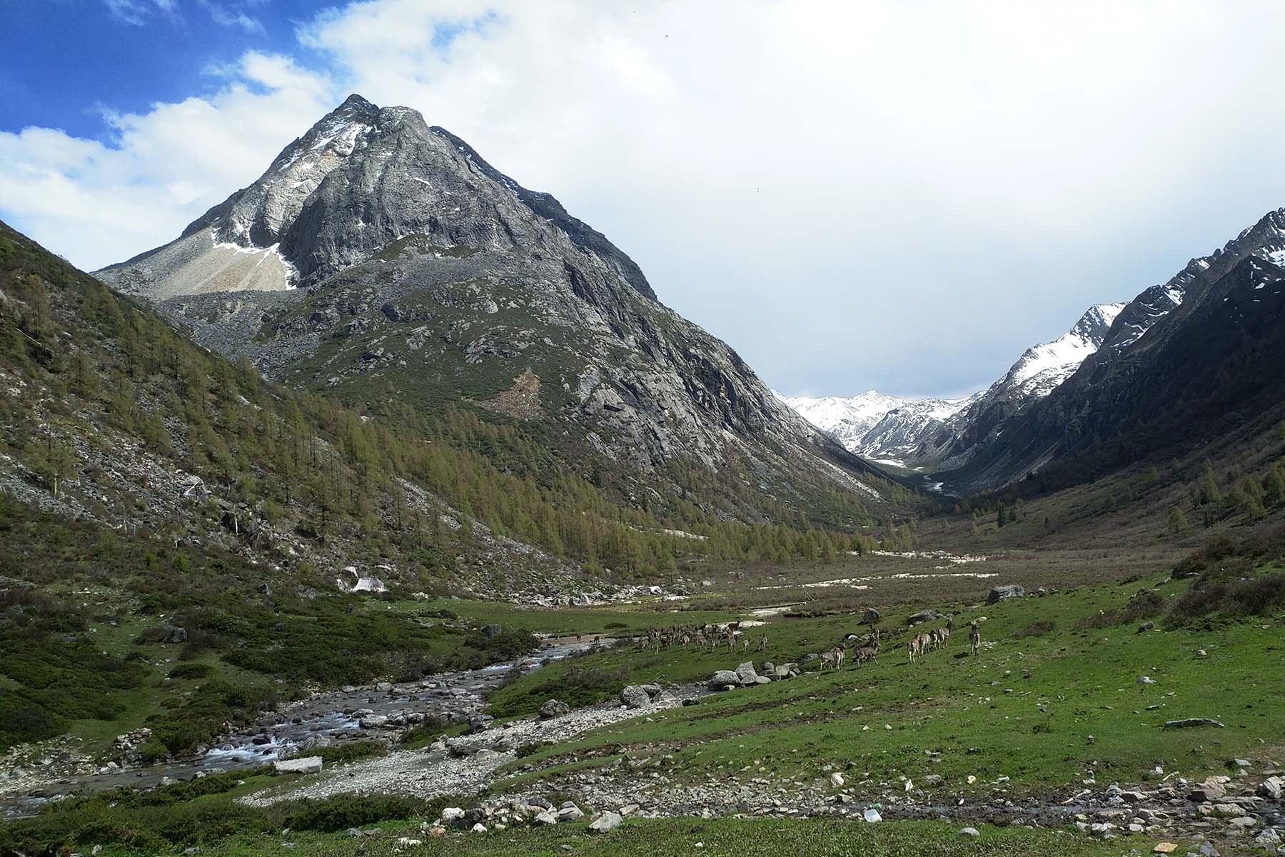
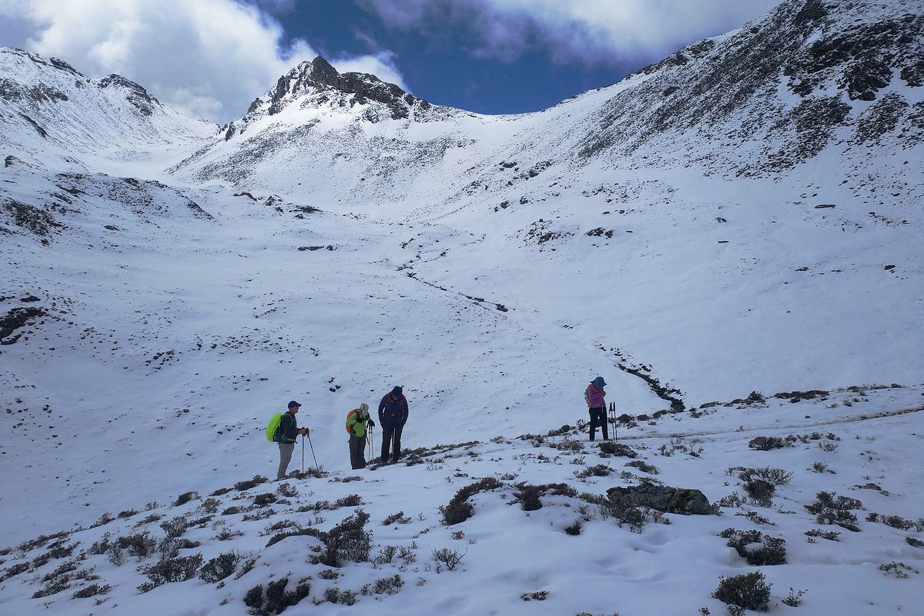
Lake by Yajiageng

Hiking by Yajiageng
Yajiageng

Yajiageng in a Clear Day
Starting from Kangding and drive for around 2 hours to have your second acclimating day for Yala Trek. The drive takes around 2 hours on very winding road and will take us from the bottom of the gorge by Kangding to the watershed pass of Zheduoshan. During busy travel season there is usually inevitable traffic with lots of cars on the road.
Arrive at Yala Mountain Road pass by around 4400m and walk up the ridgeline to around 4600m. We will have stunning views of the mountains around inclduing Lotus Mountains, Zheduo Mountains and more. It is going to be windy by the ridge but the views are worth the walk up. We have a chance to see cloud below us in some days. This part of Sichuan is actually the eastern edge of Tibetan Plateau: By the east of the ridge it has lower altitude, deep gorges and warm current while by the west of the ridge it is highland with altitude over 3500m or 4000m and with dry air.
We will walk for around 3-4 hours and then come back down the same way to the road and then drive back to the village of Zhonggu. We will have a short stop by the lake of Honghaizi either on the way up or the way down. We shall arrive back to village in the afternoon. After arrive at your hostel you have a chance to enjoy local natural hot spring before dinner. Re-pack your packs and be ready for the next days’ hiking.
Total Walking 4km between 4400m and 4600m. Easy Pace.
Overnight in hotel by 3100m.
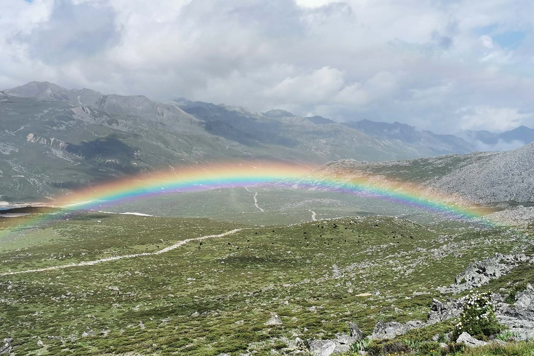
Rainbow after Rain
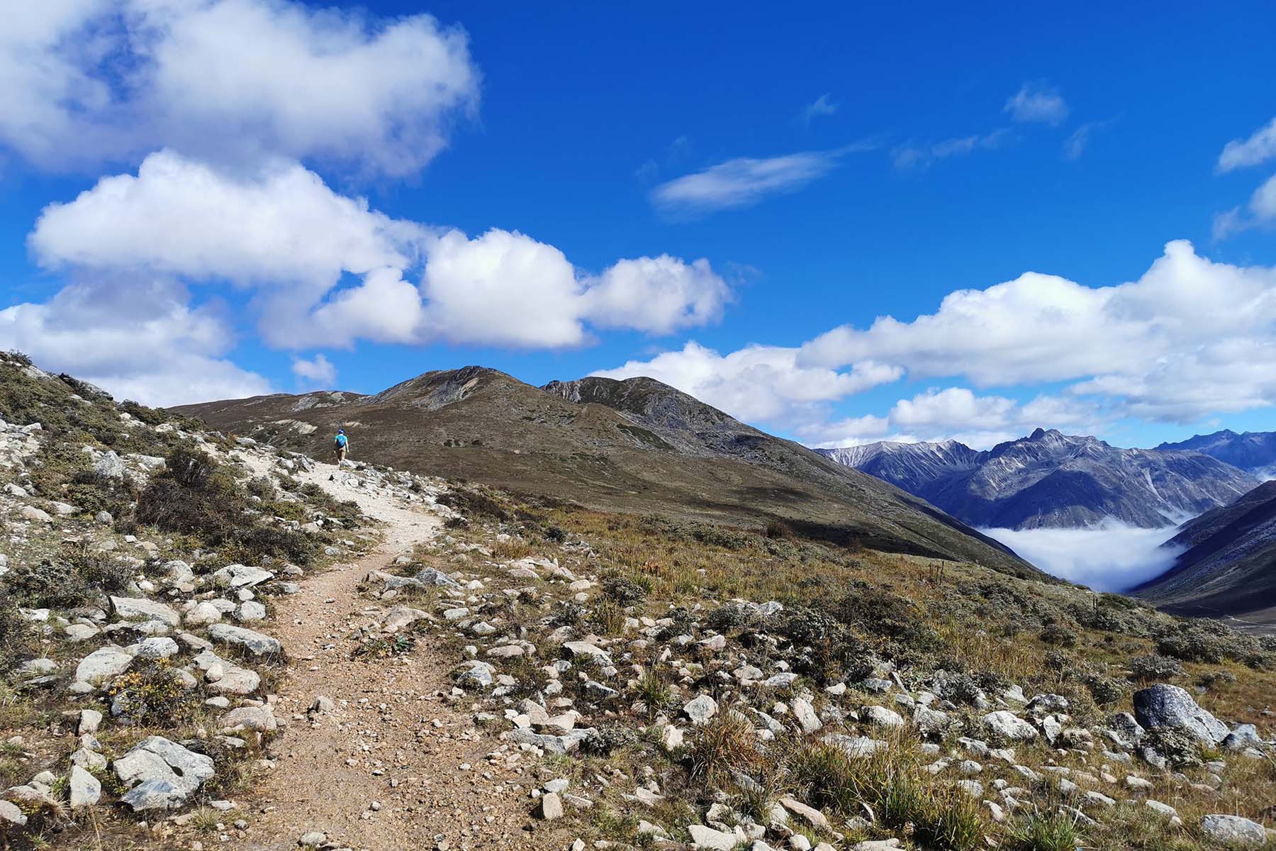
Hiking up the Ridge
View by Honghaizi Lake
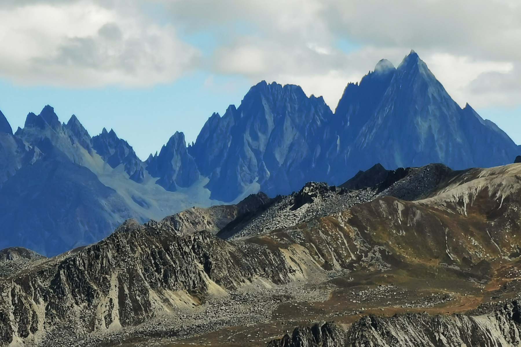
The Lesser-Known Lotus Mountains
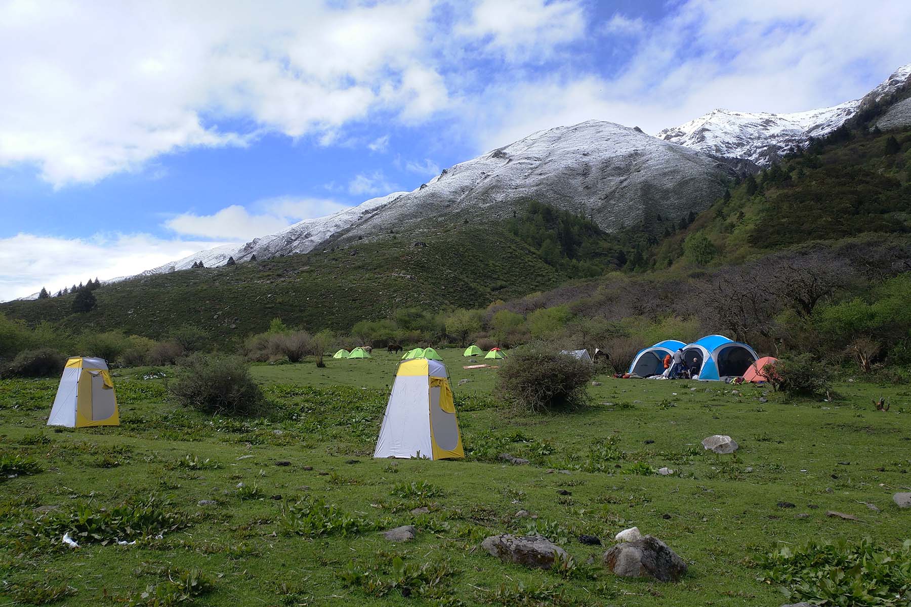
We will meet our porter team in the morning and give the heavy packs to the horses. We will first use a short local ride for around 5 minutes to get to hiking starting point and start to walk alongside a creek.
The packs that will be given to the horses are sorted the former night. You only need to carry your own day pack. Remember in the day pack we only take with us necessary items for the hiking during day time, including packed lunch or snakcks, drinking water recommended 1L minimum, sunglasses, rainproof, warm-keeping clothes and hat, sun block and lip oil, important personal possessions etc. Note the warm-clothing and rainproof (for both yourself and your pack) may not be used while hiking but since weather changes quickly and hard to predict in the mountains, it's wise to bring these items with you all the time each day.
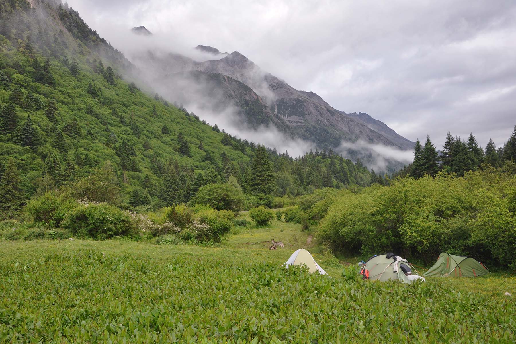
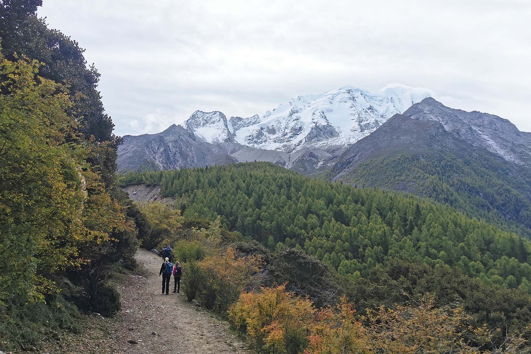
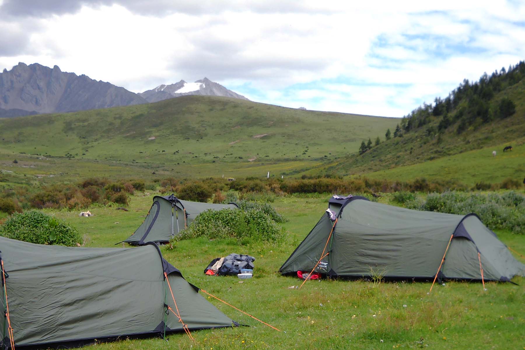
The hike starts on gradual horse trail by the riverside and then ascend up to the woods before we get open views of the valley. We will walk for around 12km from 3200m to 3500m and arrive at Xindianzi. Today is rather an easy day as it is the first day of hiking. Acclimate youself while walk with a comfortable pace and enjoy the nature around you. After arrive camp you have some extra time to relax yourself and have some time to get yourself oriented by first night camping. Our camp is called Xindianzi, an open land with some deserted stone huts used by local yak herders. There is running water from a creek from the mountain where we will get our water from. You will be briefed on where to use toilet and where to take water.
Overnight camping by 3500m.
Mt Yala Hiking
Xindianzi Camp
Wake up in the quiet morning in the nature and have breakfast. In summer time it will usually by foggy in the morning and full of dew water on the grass so be careful while walking around the camp.
After breakfast start to pack your tent and have your day pack ready for today’s hiking. You can leave your big pack to us like you did yesterday. If tents are still wet then we can leave it for more time to dry and our staff will pack tents while you start walking and don’t waste the morning time in the mountains.
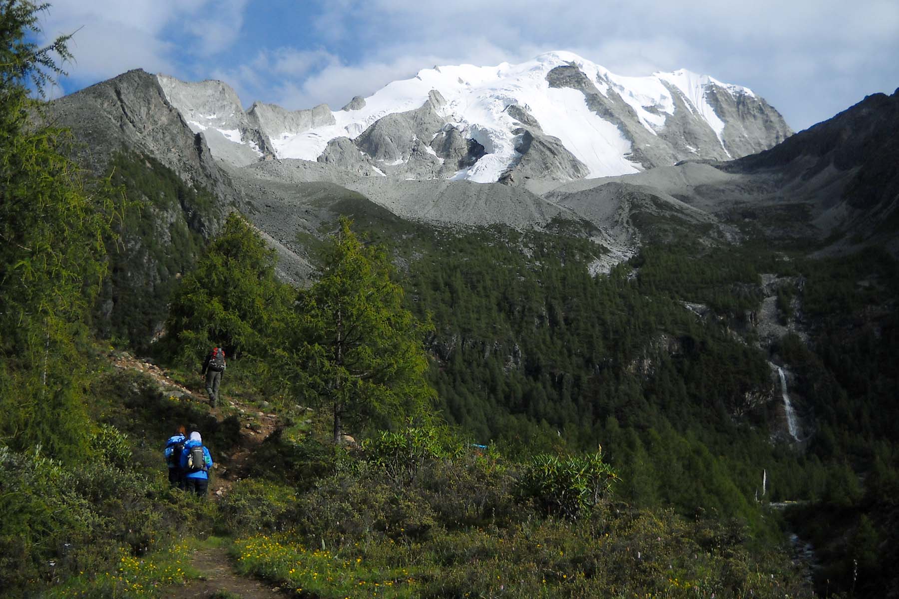
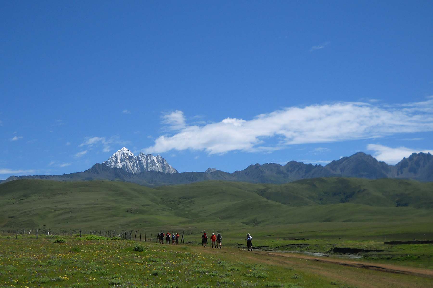
Start by continuing in the valley and on the horse trail with gradual ascent for the morning for around 7-8km before we start to have our first steep ascent to our first pass to around 4200m. The pass feels long and the final part is steep. As we go higher the views get better: we shall see the Lamoshe Mountains (peaks north of Minya Konka and with elevation of around 6000m) whle looking back to the valley we just walked. We shall also see the southface of Mt. Yala and its side peaks while walking up the pass. Trees will disappear while we walk higher and started to see shrubs and then rocks by the side of trail.
It is usually very windy by the pass of 4200m. We shall still see a deserted small fortress right by the top of the pass by the side of prayer flags that are hung by the Tibetan Buddhists. From the pass we will walk at over 4000m with small ups and downs but generally flat terrain and will pass two sister lakes between the mountains. Views are open but weather is very changable: we could have sunny weather and haily weather in a short period of time or even at the same time especailly in the afternoon from May to September. If you are traveling in these seasons you are strongly recommended to have your rainproof, windproof with you for today’s hiking.
After around 2 hours’ walking passing the sister lakes we will drop down a bit to our today’s camp by around 4100m and set camp by the foot of Mt. Yala North. Today’s camp is usually windy it is important to keep warm. You will see the mountain all the time from our camp.
Total Walking 14km between 3500m and 4200m. Medium Pace.
Overnight camping by 4100m.
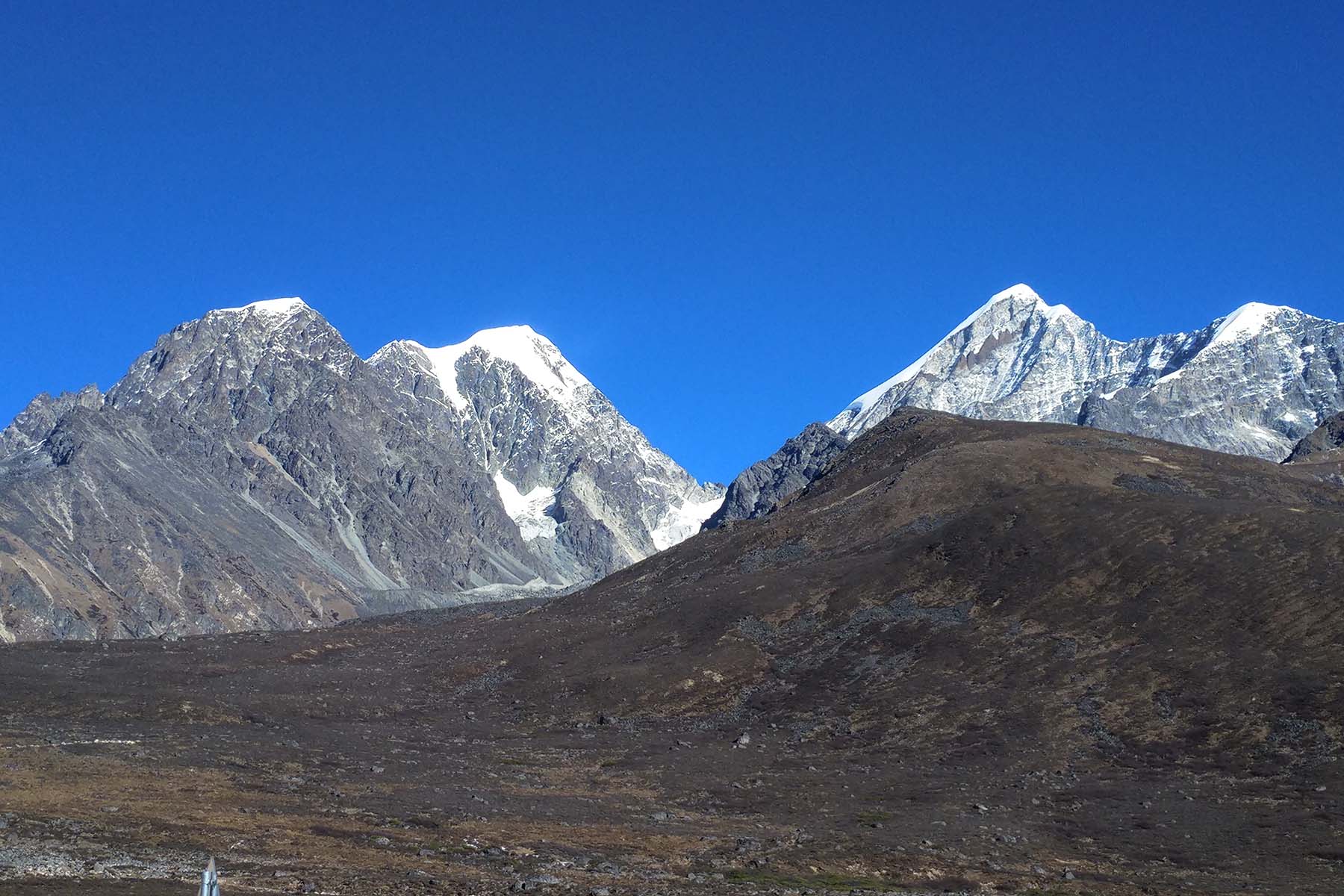
Mt. Yala after Snow
Hiking up the Pass
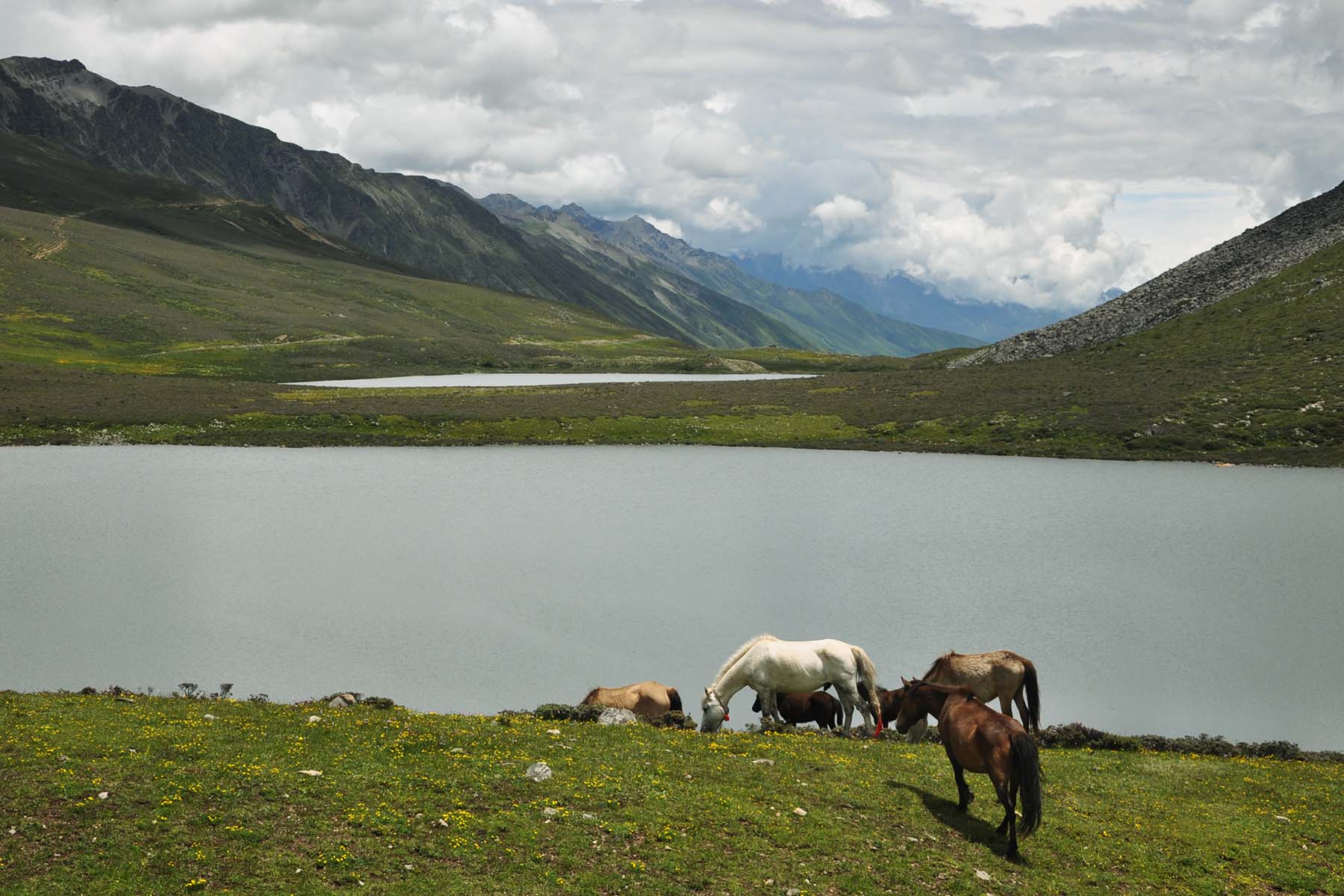
Sister Lake of Mt. Yala
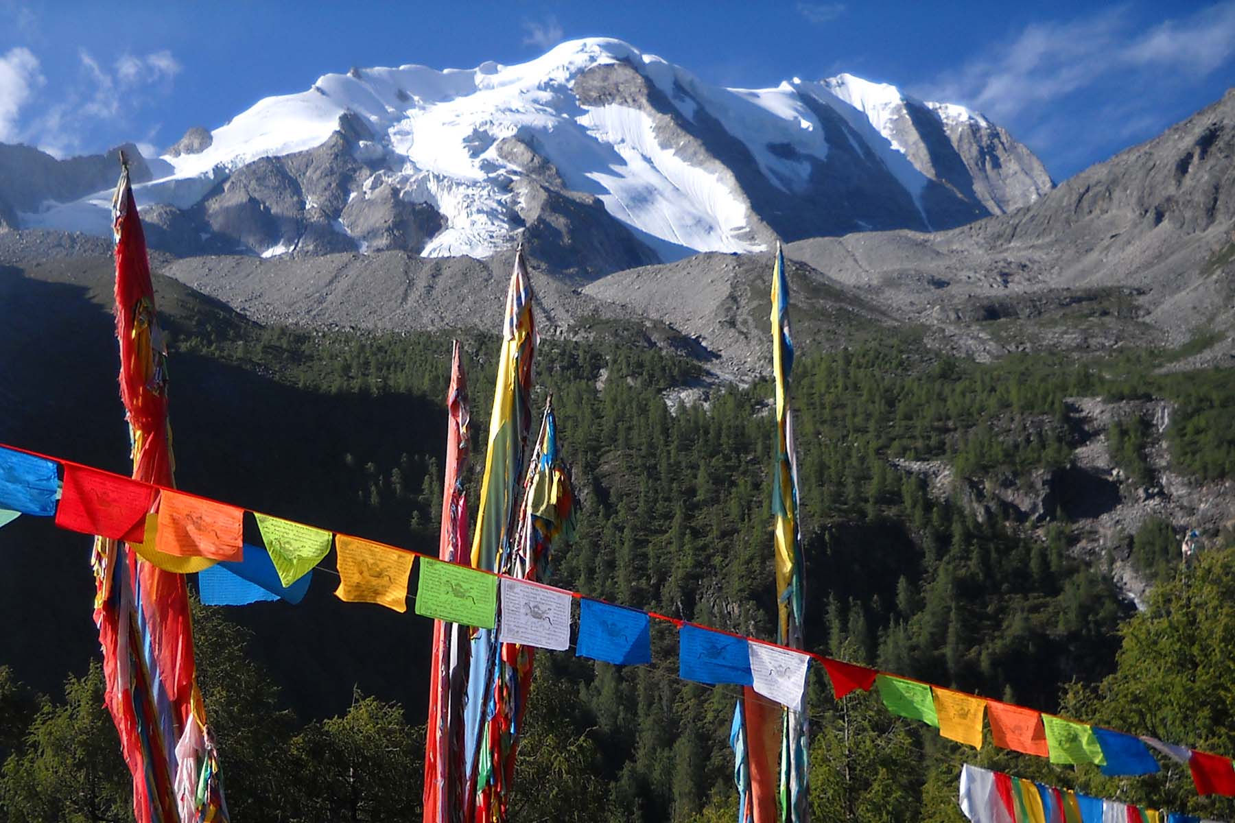
Holy Mountain Yala
TWe will eat breakfast while watching the morning glow on the mountain. If you are a photo lover you may consider to walk up earlier and then walk around to take some good photos around the camp. After breakfast go pack your day pack and start to walk.
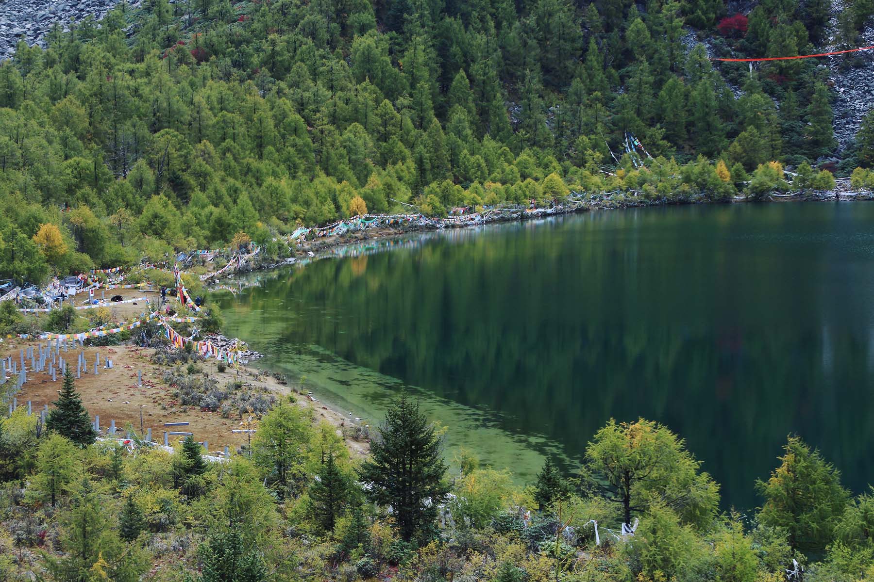
We will first have a detour to the lake of Yumtso by walking up the forest to the lake for around 1.5km. Yala Yumtso is the full name of this lake and it is a holy lake according to lake people. During certain seasons monks and Buddhists gather here to to praying and celebrations. We will see lots of prayer flags by the side of the lake. We will spend around 0.5 to 1 hour’s time by the side of the lake to just relax and take photos of the small waterfall, glaciers and mountain before we start to go back down.
We will drop from the lake by around 4100m to around 3800m in 2km to the newly-established tourist park of Mt. Yala where we will be walking on paved road for a few hundred meters before we cross the river and continue on walking on horse trails. The park of Mt. Yala runs tourist buses between road y the south to the base of mountain by the river-crossing point. It provides a quick exit alternative for those who need to evacuate. However it also makes the walking down from the lake to the river-crossing point busy sometimes especially during busy travel seasons.
After the river we will continue walking in the forest alongside another vally up to the Hot Spring Camp. This is rather a less-walked trail in this region with its more primitive forest and beautiful views of mountains. After around 3-4 hours we shall arrive today’s camp. It is overall a grandual walking up from 3800m to 4100m. View is very open by today’s camp.
A big deal for today is the open and natural/wild hot spring that we can use after arrival. There are three open and wild hot spring pools used by local people that everyone else is free to use. So please remember to pack your swimsuit for this trek! There is also chance to see wild animals including Himalayan Blue Sheep. After dinner take a good rest and prepare for the next day’s hiking.
Total Walking 9km between 4100m and 3800m. Medium Pace.
Overnight camping by 4100m.
Mt. Yala North
HYumtso Lake by the foot of Mt. Yala
Mt. Yala in Winter
Mt. Yala in Autumn
Hot Spring Camp
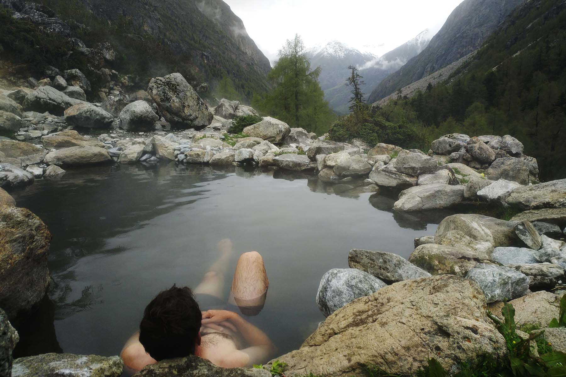
Enjoying the Hot Spring
Today is the most strenuous day of walking. We will start earlier than usual.
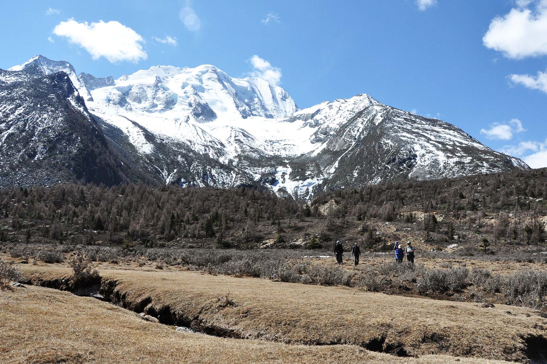
After one hour’s walking up to the same valley and traverse up to the pass. You will ascent three big terrains before reach the pass at about 4800 meters. The walking up is a little difficult but the views will make the effort worth. Found your own comfortable pace while walking up on the steep trail. As we gain elevation we also gain views of the mountains and valley around. We will have the full view of Mt. Yala westface as we go higher. We will make multiple short breaks while walking up and make sure we don’t water too much time by each break.
In a hiking group we try to stay together as a team especailly after snow when trails are not so easy to be recognized. After usually around 5-6 hours we shall reach the pass by round 4800m. At the pass we will have the full views of Mount Yala at a really close range. On the other side to the pass by its west, we will have the views of the vast rolling land of Tagong. Make sure we are warm and safe by the pass while taking photos and celebrating the moment since it is usually very windy by the pass.
After the pass it is all the way going down and it is the real challenge for some. The first part of the descending is very steep and can be slippery due to the small rocks. Try to walk slow and steady by using your walking poles and follow the instructions from your guide on how to walk on this steep terrain. After the first part of around 200 meters the trail becomes more solid but still very steep. We will continue descending for the next 30 minutes before we walk on grass again.
In a clear day the walking down Tagong Grassland from the pass is a treat to the eyes. After around 2 hours total descending we arrive today’s camp by Tailai Valley by a small river. Today’s camp is different than the former nights’ camp as it is on grassland with more open views and possibly windy conditions.
Total Walking 12km between 4100m and 4800m. Challenging Pace.
Overnight camping by 4000m.
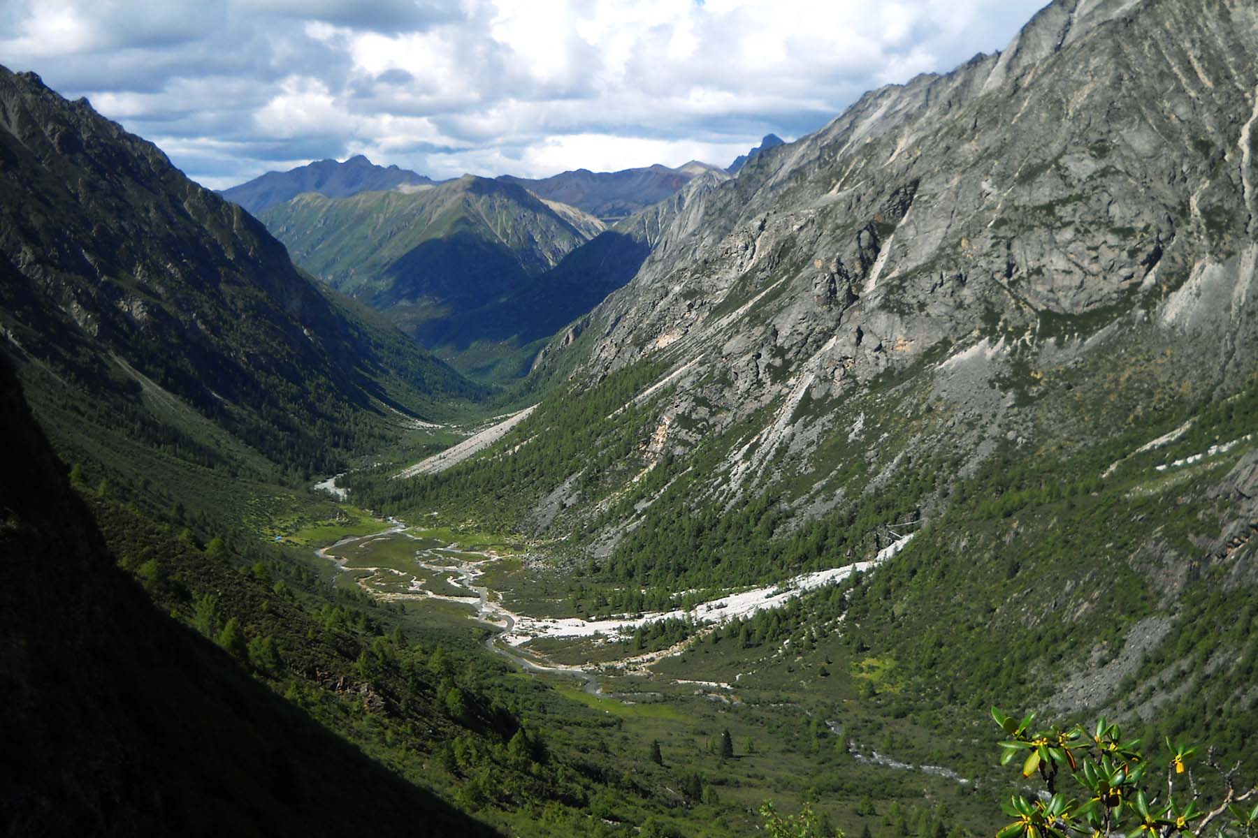
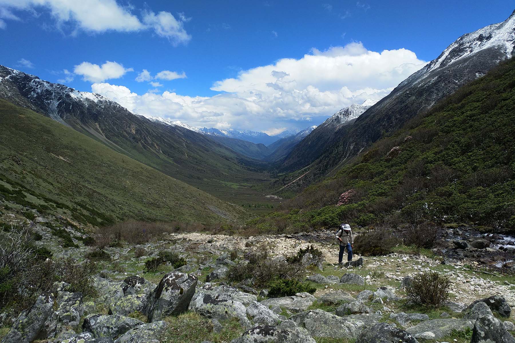
Looking Back the Valley
Mt. Yamu Northface
Walking up the Pass
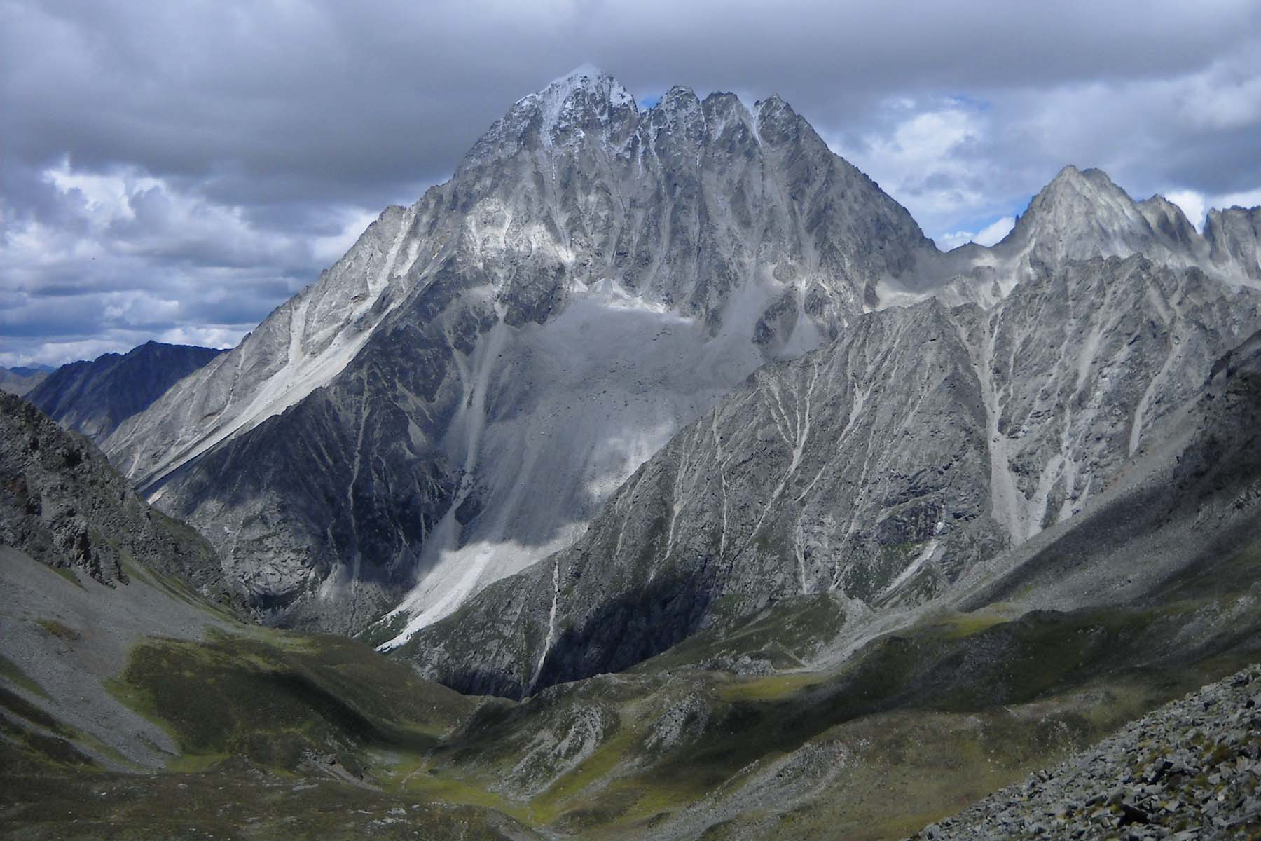
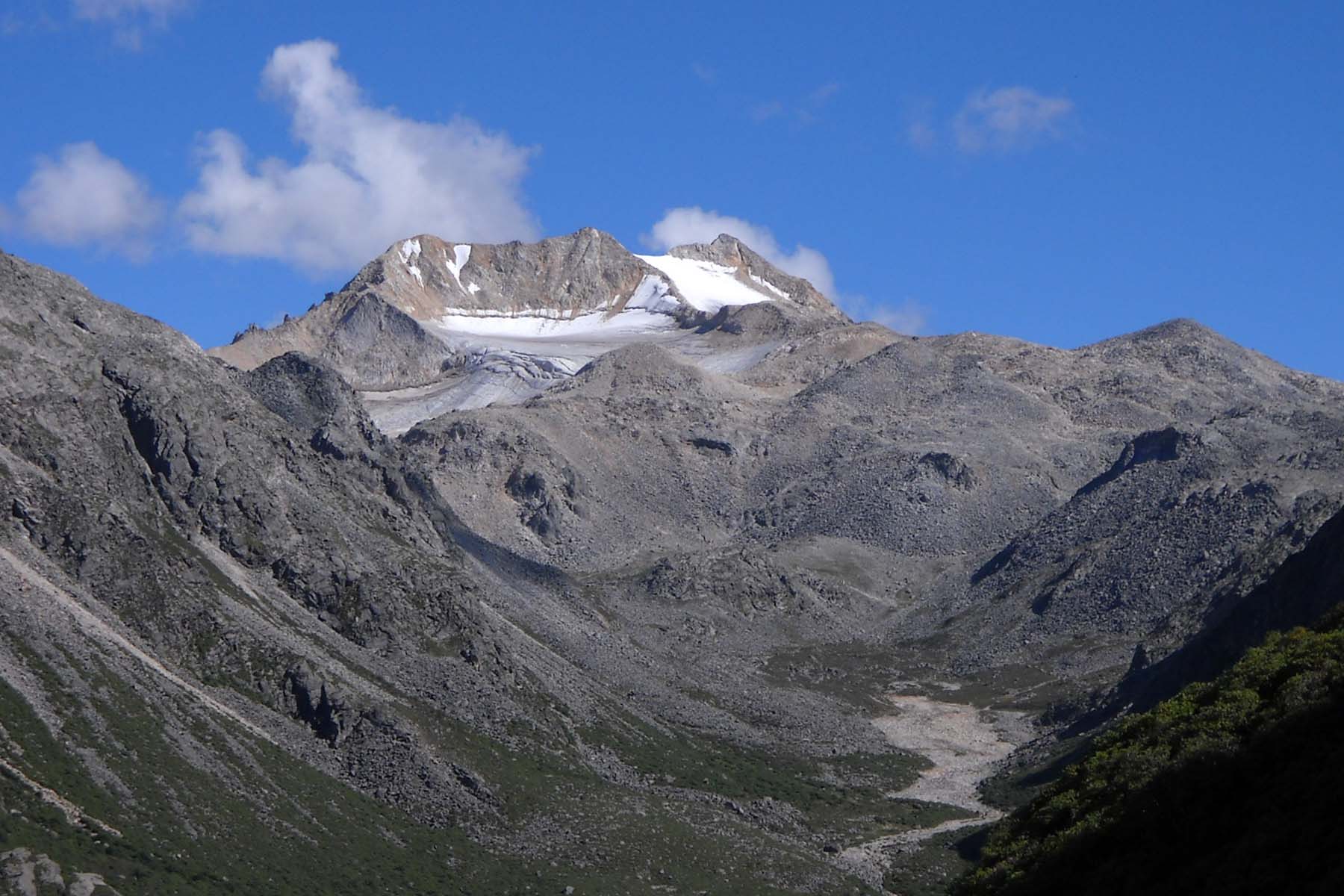
Mt. Yala is a 5820-m Mountain

4800-m Pass

Tagong Grassland
Today is our last day of Mt. Yala and Tagong Grassland Trek.
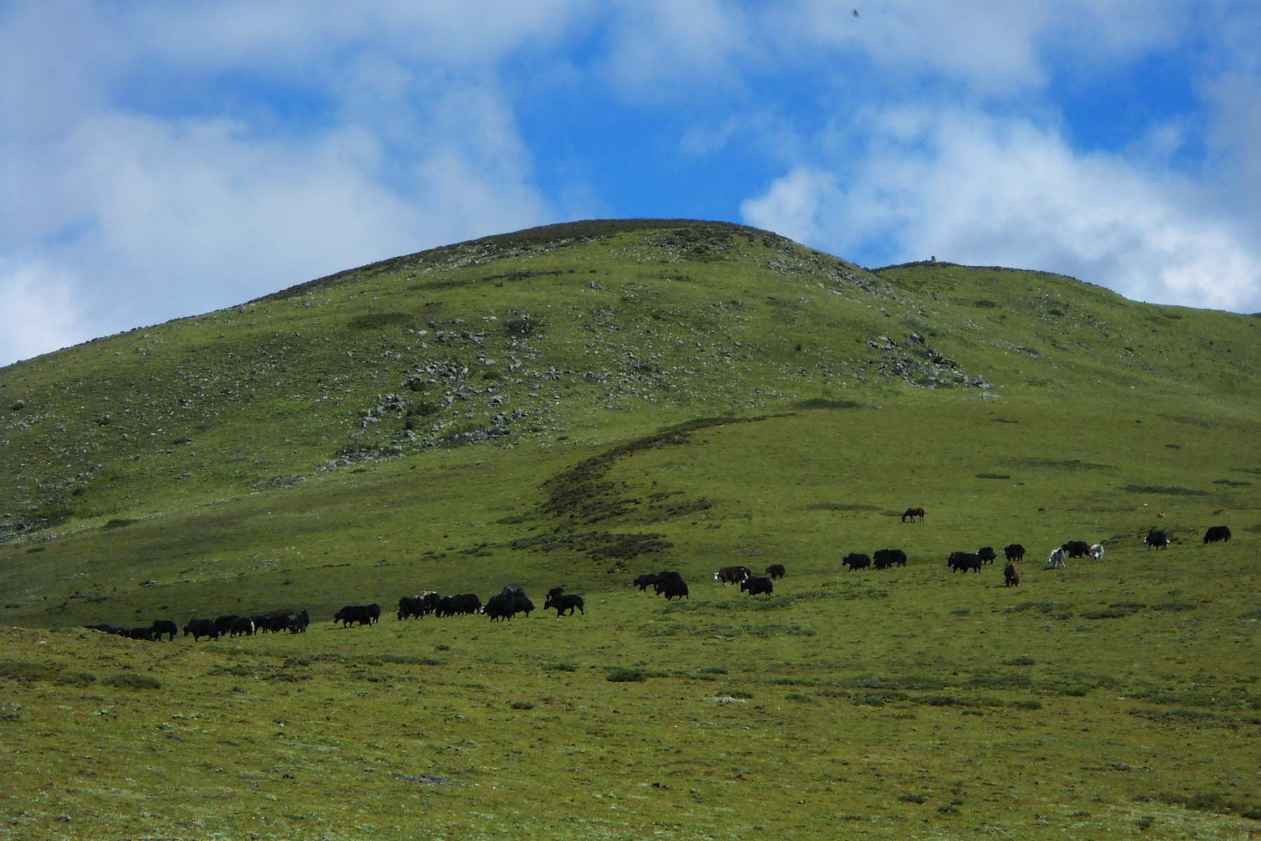
We will continue on walking in the valley following the river for another 5km on flat terrain on Tagong Grassland. We shall see groups of yaks and completely different life style of Khampas than that of Kangding. Here people live a rather nomadic life with a lot of time spent on the grassland with their herds. During herding season we may run into one or two local nomads people and we even have the chance to visit their yak tents if available. It is ineresting to see how local yak herders are living their lives.
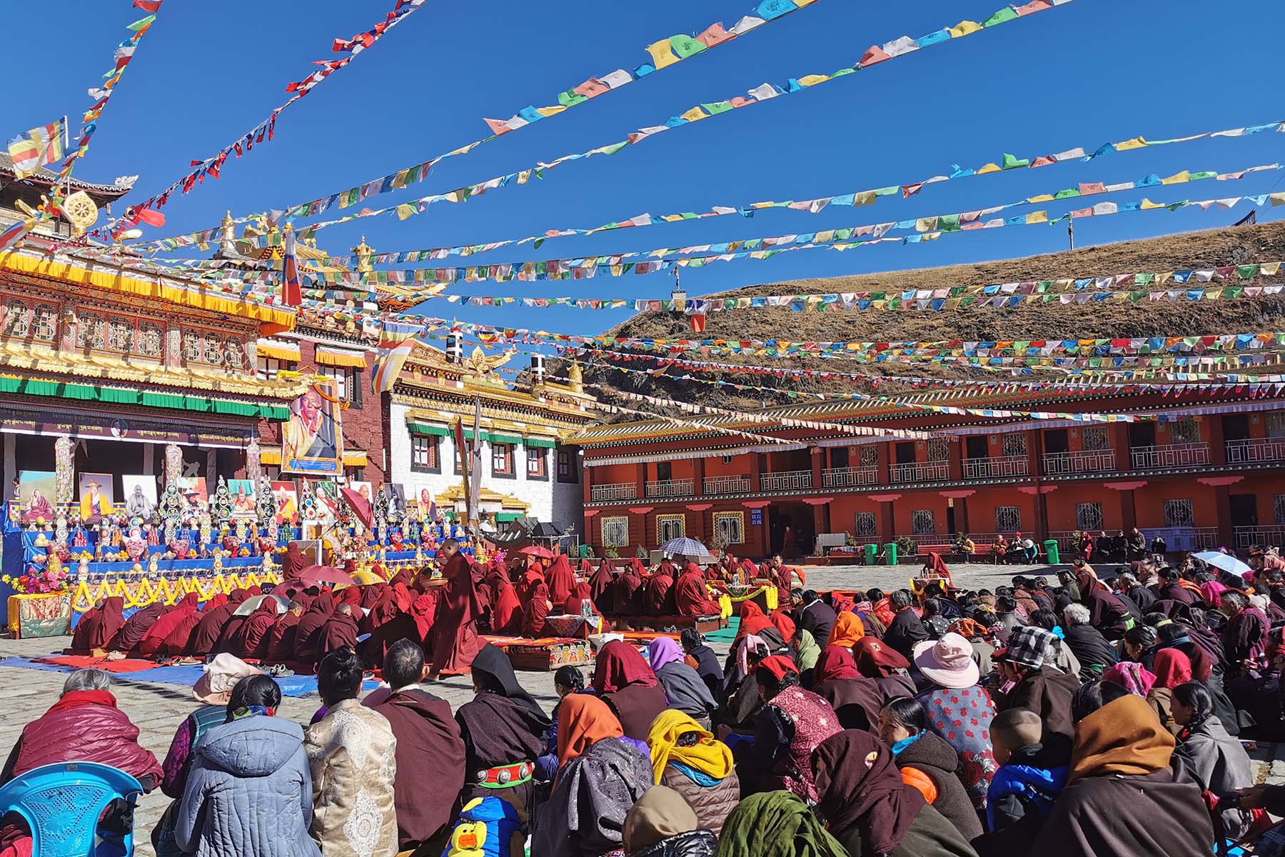
After 6km walking we arrive by our trekking terminal by Anigongma Village, an authentic Tibetan Buddhist village near Tagong and the best highlight of Tagong Grassland. Here we can go visit the Muya Grand Temple, Anigongma Nunnery if available. We will also to go see the big Mani Stone Pile of Tagong on our way out. We have around 2-3 hours’ time spent here to explore the local village, monastery, nunnery here in Anigongma.
By Anigongma we will say goodbye to our porter team as they will start to go back home. Thanks to their hard work and effort so that everyone can enjoy this trek.
Afterwards we drive for around 20 minutes to the town of Tagong for hot shower and relax. And if time allows we will go visit Tagong Monastery, a 1300-year-old Sakya Monastery of Tibetan Buddhism located in the center of Tagong.
Total Walking 6km between 4000m and 3900m. Easy Pace.
Overnight hotel by 3700m.
Tailai Camp
Tagong Gassland
Tagong Hiking
Tagong Landscape
Today we have a full day drive back to Chengdu or you can fly back to Chengdu from airport of Kangding. Your Mt. Yala and Tagong Grassland Trek ends.
Tagong
Tagong Monastery
Winter is not recommended for this Kangding Hiking. A good time to travel here would be from May, to November. In the monsoon season July and August the mountains are green. In September and October, weather starts to get cold.
Strong walking boots are necessary to do this trek. In this hiking, some sections of the walking trail are rocky and muddy.
Rain proof and Sun block are also necessary when you come to hike at Kangding. The average elevation of this hiking is over 3500 meters. Weather changes quickly.
Traveling to the listed places will expect lower standard services at hotels and restaurants even if they maybe the best choices. The service level is not as up to what you have in places like Chengdu. The hotel people don't speak English nor do the people from restaurants. These places are quite far, wild but beautiful. As authenticity comes often with less comfortability. Public Toilet can be really bad. You are always recommended to use your toilet in your hotel while you don't want to use the public toilet or do it in the open wild. You are recommended to have toilet paper with you. Food are with limited options at most of the places. Basically you can find Chinese Food with Sichuan style. On a guided trip you can have them customized into vegetarian or non/less spicy.
Please complete belowing form and submit it. Our staffs will contact you as soon as after we receiving your inquiry.